Introduction
Throughout 2021 and early 2022, Council officers walked and cycled the existing network of off-road, active travel routes in East Dunbartonshire. While doing so they recorded the location, surface, features and condition of paths. The following section details the findings of this process, looking at the current state of the network in East Dunbartonshire as a whole as well as individual communities. Note that the network’s scale and paths’ nature means that new issues arise regularly and soon after the date of publication this information will be incomplete. The upcoming Active Travel Strategy will include a proposal for regular monitoring of East Dunbartonshire’s active travel network.
On this page you will find information on:
Methodology
Using the ArcGIS Collector smartphone app, officers from East Dunbartonshire Council walked and cycled the off-road active travel routes in the area, as well as some paths in neighbouring areas with connections to and/or particular significance for East Dunbartonshire. The app enables the auditor to record various features of the paths identified as forming the off-road active travel network. The features that can be recorded and the aims of recording that information are detailed in the next section.
Aims
This report gives a general overview of the extent, condition and features of the off-road active travel network in the different communities of East Dunbartonshire. The data collected from the network audit will contribute to actions in the forthcoming ATS as well as provide information that informs the ongoing maintenance of the network. The audit returned data in the following areas:
- General comments: this allowed data to be collected about overarching views and any other concerns an auditor had with a path that didn’t fit any other category.
- Route information: the surface, condition and who can use a route
- Barriers: any obstacles or obstructions that impede the use of a path including gates, steps, crossings etc.
- Cycle parking
- Maintenance issues: potholes, vegetation, root damage, surface/edge damage
- Signage: signage is recorded as existing, missing or damaged to understand where signage needs upgrading
Each area has a table that, drawing from data collected during the network audit, provides a summary of the local network’s strengths, weaknesses, opportunities and threats (SWOT). The following sections will look at areas within East Dunbartonshire, their off-road active travel network and provide information about the condition and features of the routes in those areas.
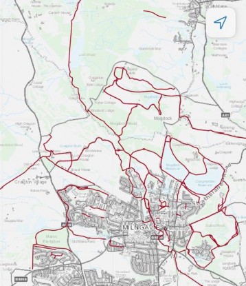
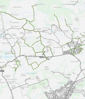
Bearsden
Bearsden, a town of approximately 28,000 people, is part of Glasgow’s contiguous urban area. It is served by three train stations (Bearsden, Hillfoot and Westerton) and multiple bus routes. The foundations of an off-road active travel network exist in Bearsden, though there are notable gaps in the network and with much of the network being off-road and unlit, the perceived lack of safety in some parts of the network presents a barrier to its use, particularly in hours of darkness.
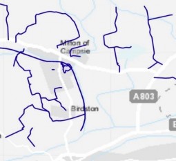
Map of the off-road network of paths in Bearsden
The map above shows that Bearsden’s three rail stations (grey circles on the map) could be better connected to residential areas by off-road paths. The Jubilee path, which extends northeast from Bearsden station is the subject of a campaign asking for improvements. This path has significant potential to improve access to Bearsden/Hillfoot stations and the Bearsway.
Bearsden is well-equipped with green spaces in residential areas and these facilitate active travel in the town, particularly for leisure and exercise. On the other hand, the town centre is not well served by active travel paths. It is dominated by infrastructure for cars and often congested, further deterring cycling on-road. Like its neighbour Milngavie, Bearsden has a strong foundation for a connected active travel network but, to serve more everyday journeys rather than leisure, consideration of what modes of transport are catered for and what locations are being connected is required.
- General comments
Two general comments were recorded about the off-road active travel network in Bearsden. One drew attention to a sign that, like similar signs in Milngavie, states that cycling is not permitted on the off-road path. These signs are damaging to efforts to encourage modal shift towards active travel.
The other general comment notes a lit, tarmac path that provides a connection across a park, linking residences and amenities near Westerton Primary School, south of Bearsden town centre.
- Route information
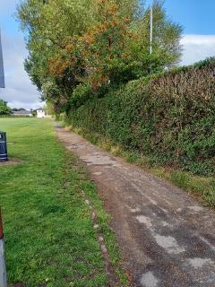
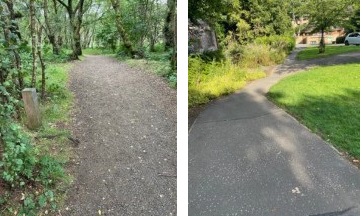
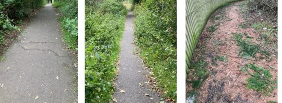
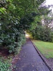
The route information function in Collector App allows the auditor to judge who can comfortably use the path and the path’s condition. The image is a path in Bearsden that was classified as in fair condition and usable by foot, bike and wheelchair. It is therefore a useful baseline to set as an average path in Bearsden, it functions as a path but clearly could be improved and therefore is judged to be in fair condition.
A path in fair condition in Bearsden – it could feasibly be used by walkers, cyclists and wheelers but clearly the surface could be improved and the route could be better maintained to ensure vegetation growth does not present an obstacle to users.
|
Hard |
Dirt/mud |
Gravel/loose |
Road |
Grass |
Boardwalk |
Other |
|---|---|---|---|---|---|---|
|
32 |
|
11 |
|
2 |
1 |
1 |
|
Very poor |
Poor |
Fair |
Good |
|---|---|---|---|
|
3 |
4 |
19 |
20 |
Pictured is a grass path in fair condition for walking. It is on the outskirts of the town and is not an important route connecting people to everyday needs. The path pictured, on the other hand, is a good, hard path for walking, cycling and wheeling. Paths like these, connecting residential areas and important services (in this case, a leisure centre and a library), are important to maintain to ensure everyone can access and use the path. One issue with these paths is safety. Although lit, the path lacks passive surveillance and, as a result, will be underused at night and during winter months. It is important to consider the quality and accessibility of on-road alternatives for when people naturally avoid off-road routes.
|
Walking |
Walking/Cycling |
Walking/Cycling/Wheeling |
Cycling |
n/a |
|---|---|---|---|---|
|
11 |
6 |
27 |
1 |
1 |
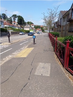
Bearsden has a high number of paths that are accessible for walkers, cyclists and wheelchair users. Pictured is Bearsway, about 150 metres from Hillfoot rail station. It is an important, high-quality segregated cycleway. As on-road infrastructure, it enhances the pedestrian experience as traffic is further from the footway. There are some barriers on the route (discussed below) and the route fails to connect Hillfoot station and Milngavie town centre. This means that cyclists must choose to either cycle on-road amongst traffic or ride on the pavement. Some cyclists lacking confidence riding in traffic choose to ride on the pavement which, in turn, impedes pedestrians and wheelchair users. This conflict was experienced during the network audit and the auditor considered it noteworthy. Greater segregation of cycling infrastructure can improve experiences for cyclists, pedestrians and wheelchair users.
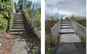
- Barriers
The most common barrier to active travel in Bearsden are steps (15), followed by road crossings (6 uncontrolled and 4 signal controlled). Also noteworthy are the long wait times at signal-controlled crossings on Bearsway. To encourage modal shift towards active travel, infrastructure should facilitate faster, easier and more convenient journeys rather than delay those who have made a sustainable transport choice.
In some instances, barriers exclude wheelchair users from routes and make it more difficult for cyclists. Two examples are the Jubilee Path near Hillfoot and the bridge over the canal near Westerton Station. In both cases, ramps could be retrofitted to ensure those with impaired mobility can safely use these important routes.
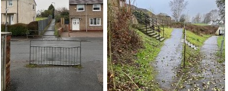
Finally, on a narrow footway, this barrier presents a significant obstacle for people wheeling or pushing prams or trolleys. If a comprehensive network for active travel is to serve the places people want to go in East Dunbartonshire, obstacles like this must be removed and footways must be made accessible for all.
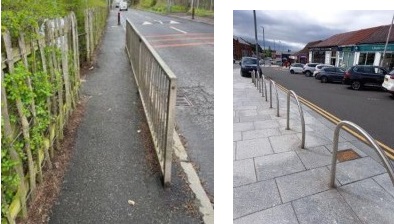
When combined with narrow footways, barriers like this between Westerton and central Bearsden represent significant obstacles to active travel for those with limited mobility or those carrying loads, pushing prams etc.
- Cycle parking
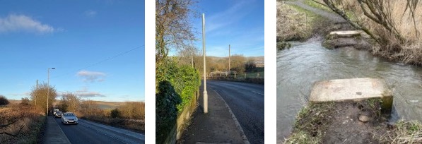
There is cycle parking at Kessington hub (on A81, pictured above) and one bike rack in Cluny Park. There is cycle parking along Bearsway with three racks available at one bus stop and one rack at another. This is an example of good integration of sustainable transport modes and the proximity of cycle parking to public transport links must be considered.
- Maintenance issues
Compared to other areas there were fewer maintenance issues recorded in Bearsden. This is due to the urban, well-used nature of the network but also suggests a degree of inequality of access to high-quality active travel infrastructure elsewhere in East Dunbartonshire.
Surface damage (4 moderate and 1 serious) was the most common recorded maintenance issue. One instance of each of the following maintenance issues was recorded; minor, moderate and serious tree root damage; serious surface damage and a pothole causing moderate damage.
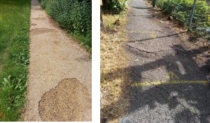
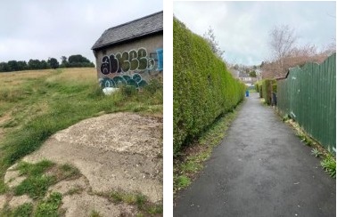
Pictured is an example of moderate surface damage. It is moderate as it does not completely impede active travel but if it continues without maintenance it will exclude users from that path. Pictured is an example of moderate tree root damage on Jubilee Path, a strategically important route linking Bearsden town centre, a nursery and Hillfoot shops, station and residential areas. This path should be maintained and upgraded to improve everyone’s ability to access places and services using active travel.
- Signage
There were at least 45 recorded signs on the off-road active travel network in Bearsden. The most common were blue signs that direct people to places of interest and provide estimated journey times for walking and cycling. In two cases these signs were damaged (one obscured by leaves and the other bent out of shape, as pictured).
- SWOT
|
Strengths:
|
|
|---|---|
|
Weaknesses:
|
|
|
Opportunities: |
|
|
Threats:
|
|
Bishopbriggs
Bishopbriggs is part of the contiguous Glasgow urban area and has a population of around 24,000 people. Bus and train connections from Bishopbriggs town centre to Glasgow and the central belt are frequent. As the map below shows, there is a network of active travel routes in Bishopbriggs. Those routes are concentrated in greenspaces and the rural north of the area. The location and unlit nature of these routes mean that they are primarily used in daylight hours for recreational purposes rather than for everyday journeys

Map of the off-road network of paths in Bishopbriggs
The map of Bishopbriggs’ off-road network of paths shows that many paths serve rural areas north of the town centre. The canal path which passes Bishopbriggs to the north is part of the National Cycle Network (route 754). Apart from a path through Bishopbriggs town centre park, which then follows Bishopbriggs Burn to the canal, most urban and residential paths are short and limited in utility if the destination is Bishopbriggs town centre. Despite some coverage of short paths in the east and south of the area, parts of Auchinairn, particularly areas near the border with Glasgow City Council are somewhat isolated from Bishopbriggs due to poor connections and poor pedestrian environments.
Auchinairn
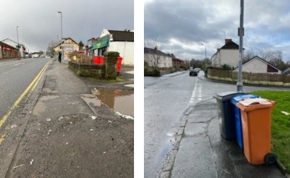
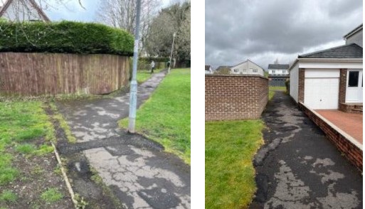
Auchinairn is one of East Dunbartonshire’s four local areas identified as requiring a specific local place plan due to issues of inequality, deprivation and poor access among others which are measured by the Scottish Index of Multiple Deprivation. Auchinairn is located next to Bishopbriggs but lacks direct train services to Glasgow. While in Auchinairn, an auditor noted the particularly poor condition of pavements connecting residential areas with key services such as shops, the community hub and a pharmacy. Pictured is an example of a poor pavement surface near local amenities in Auchinairn. Pictured is another example of hostile pedestrian environments in Auchinairn. Wheelchair users or people pushing prams will be forced onto the road and face a lack of dropped kerbs and long crossings. To ensure equal access to local services and amenities, pedestrian infrastructure should be assessed and upgraded in East Dunbartonshire.
A constraint of the network audit process is that, in focusing on the off-road active travel network, pavements, the most widely used infrastructure used by walkers, are ignored.
- General comments
There are two routes on the map (both northwest of Bishopbriggs, near HMP Low Moss) that do not exist. There is little need for routes in this area in the short-term although future development may create a need.
The southern canal path and the Cadder Loop were both noted to be in poor condition, overgrown, narrow and muddy in places.
- Route information
|
Hard |
Dirt/mud |
Gravel/loose |
Grass |
|---|---|---|---|
|
11 |
2 |
4 |
2 |
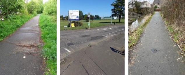
The path pictured is a gravel path for walking, cycling and wheeling graded fair. This path is generally fit for purpose. However, it is signed as the main cycling route from Bishopbriggs to Glasgow, a purpose for which it is not fit and it is neither the most direct nor the quickest route. The poor surface in comparison to main roads and the indirect nature of the route forces cyclists to either use busy, main roads, add time to their journey or choose a less sustainable form of transport.
|
Very poor |
Poor |
Fair |
Good |
|---|---|---|---|
|
1 |
4 |
9 |
5 |
Pictured is an example of high-quality off-road active travel infrastructure in Bishopbriggs. The recently developed area to the east of Auchinairn has a somewhat extensive off-road network. There is an opportunity to extend this towards Auchinairn and Bishopbriggs to reduce car dependency and improve transport links to neighbouring, deprived, areas.
|
Walking |
Walking/Cycling |
Walking/Cycling/Wheeling |
|---|---|---|
|
3 |
5 |
15 |
- Barriers
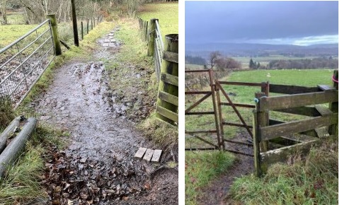
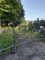
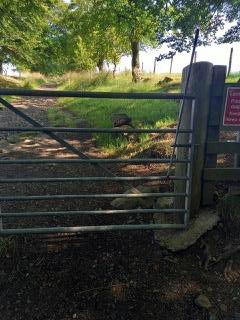
The most common barrier on the off-road active travel network in Bishopbriggs were gates (9), followed by signal-controlled and uncontrolled crossings (3 each). There were three inaccessible routes, one overgrown route which limited access, one set of steps and one bridge (wide and easily accessible).
Pictured is a barrier that did not fit in any of the prescribed categories. This barrier was due to temporary works on Wester Way and it impedes cycling and wheeling on the otherwise high-quality route.
Pictured is one of Bishopbriggs’ gates which act as barriers to active travel. A person with unrestricted mobility may not notice an issue with this infrastructure but those who use wheelchairs or push prams will find these barriers restrictive to their ability to move around. If East Dunbartonshire is to be a welcoming, enjoyable place to travel around actively for all, these barriers need to be addressed.
- Cycle parking
There is some cycle parking in central Bishopbriggs in the main square across the road from the station and extensive cycle parking north of the town centre at the entrance to Bishopbriggs Park.
There should be more cycle parking that allows journeys to be easily made by a combination of active travel and public transport.
- Maintenance issues
There were fewer maintenance issues recorded in Bishopbriggs than in other areas. This is likely not due to there being fewer maintenance issues in Bishopbriggs but rather inconsistencies in how data was recorded. Some officers recorded maintenance issues as route information and general comments. These sections describe some rural paths north of Bishopbriggs as being narrow, overgrown and muddy.
One minor and two moderate instances of surface damage were recorded (moderate damage pictured). Two instances of minor damage due to vegetation were recorded. One instance of minor pothole and minor tree root damage was recorded. The surface damage pictured is combined with vegetation which could be better maintained by the Council. Particularly when wet or in winter months, this path would be difficult to use for those with limited mobility.
- Signage
Bishopbriggs, and particularly its urban path network, lacks the comprehensive signage of other parts of East Dunbartonshire. Signage is largely limited to canal paths and paths through Bishopbriggs Park. Aside from one damaged sign that was twisted to point in the wrong direction, there were nine existing signs in reasonable condition. A typical sign from the canal path and park is pictured These signs are understandable and similar to typical blue active travel signs seen throughout the region.
SWOT
|
Strengths:
|
Some good quality infrastructure for active travel; notably the canal path which mostly caters for leisure activity. This path is well-signed. Bishopbriggs Park has ample cycle parking. |
|---|---|
|
Weaknesses:
|
Lack of routes connecting residential areas to local amenities and services. This means that people are forced to travel actively on often substandard footways (see Auchinairn section above). Infrastructure fails to form a complete network. Lack of integration between active travel and public transport. |
|
Opportunities:
|
A more direct route to Glasgow; GCC’s active travel strategy presents opportunities for cross-boundary connections. More town centre cycle parking would create opportunities to combine active travel and public transport on the same journey. |
|
Threats:
|
Lack of maintenance means that issues of poor surfaces, overgrown vegetation and tree root damage worsen and make paths inaccessible for cycling and wheeling. |
Kirkintilloch
For this audit, the Kirkintilloch area is large, covering Lenzie and Waterside to the southern boundary of East Dunbartonshire and Twechar to the eastern boundary.
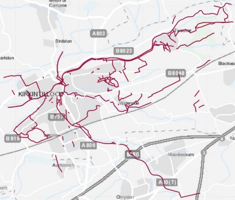
Map of off-road paths in Kirkintilloch
The Kirkintilloch area’s paths include the Forth and Clyde canal path (part of the National Cycle Network route 574). The John Muir Way passes through the area, following the Strathkelvin Railway path (SRP), then the canal before turning off the canal at Twechar, passing the Antonine Wall and Bar Hill roman fort before crossing the border with North Lanarkshire near Croy. These marked, high-quality long-distance paths are assets to East Dunbartonshire, providing residents with recreational opportunities and attracting visitors. Other areas with networks of off-road active travel paths for leisure are Lenzie Moss and Waterside.
As the map above shows, Kirkintilloch town centre appears to be better connected to its peripheral residential areas than other towns in East Dunbartonshire. Hillhead, east of Kirkintilloch town centre, is poorly served by off-road paths. This is one of East Dunbartonshire’s most deprived areas and consideration is required regarding how to better connect the area to local amenities, public transport links and green space via active travel.
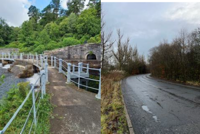
While there are some paths within Waterside, the area lacks connection to neighbouring settlements. The on-road route to Lenzie station is notably hostile to active travel.
- General comments
Due to slightly different methods in recording data amongst different officers (as described in Bishopbriggs section), there were more general comments for Kirkintilloch than for other areas, although the data recorded for most will be used in the route information section.
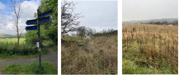
General comments informed of various features and issues: access to Waterside Bing is confusing as there is no access through the depot, there is lighting on the floor of a few paths (notably north of the canal in Kirkintilloch to St. Ninian’s High and in Twechar – the auditor asked whether this lighting is fit for purpose i.e. bright enough to provide users with a feeling of safety, steep and slippery surfaces were noted in Twechar as well as a steep section up towards Bar Hill although a path bypassing this section was available, this area was also noted to require better signage as walkers could become disorientated, a path west of Kirkintilloch was noted to have poor access via a fast road and narrow footway.
- Route information
Kirkintilloch has a mixture of urban, suburban and rural paths so there are significant variations in surface, quality and intended users of paths. Pictured is a section of path at Lenzie Moss, this is a good quality gravel surface which could be used comfortably by walkers and cyclists. The path is unable to be used by wheelchair users due to the sections of boardwalk which cross boggy areas.
|
Hard |
Dirt/mud |
Gravel/loose |
Grass |
Boardwalk |
|---|---|---|---|---|
|
30 |
3 |
7 |
2 |
1 |
Three paths were entirely inaccessible and one path was partly inaccessible. Two paths did not exist.
|
Very poor |
Poor |
Fair |
Good |
|---|---|---|---|
|
1 |
6 |
18 |
17 |
|
Walking |
Walking/Cycling |
Walking/Cycling/Wheeling |
|---|---|---|
|
12 |
11 |
23 |
The path pictured is a short, hard-surfaced off-road route in Lenzie, graded good. That said, the path has a notable slope and may cause issues for wheelchair users. Paths that form an accessible active travel network should consider the needs of all users.
- Barriers
Like other parts of rural East Dunbartonshire, there are numerous gates on routes intended for walking (at least 19 recorded). The majority of these gates are in very good condition and are fit for purpose. More concerning as a barrier to active travel are uncontrolled road crossings (13 recorded) like that on the John Muir Way east of Twechar and in Twechar itself, a town that commercial traffic uses as a cut-through. Such crossings are hazardous to walkers and present a significant barrier to active travel.
Like the path’s gradient observed in Lenzie, a barrier to active travel that may go unnoticed was recorded in Twechar. Located on the main street the placement of this pole makes it difficult for wheelchairs and prams to pass and people with mobility issues are forced closer to the road than they would like.
- Cycle parking
Kirkintilloch town centre has some existing cycle parking and facilities. There are at least 24 cycle racks in the town, 10 of which are covered. There is a damaged facility for inflating bike tyres.
- Maintenance issues
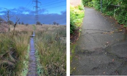
Like in Bishopbriggs, there were some issues with consistency of data collection and this is reflected in the smaller amount of maintenance issues recorded in Kirkintilloch. As recorded in the Lennoxtown area, the SRP has significant maintenance issues related to tree root growth damaging the surface and making it difficult and dangerous for cycling (serious tree root damage north of Kirkintilloch pictured).
Pictured is an example of a poorly maintained crossing (recorded as serious surface damage, but there are multiple issues). The surface, kerb and lack of amenity to help pedestrians cross safely. A combination of these factors both in this instance and at many other crossings and paths in East Dunbartonshire combine to contribute to people making unsustainable transport choices.
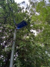
An important single maintenance issue recorded on the path to St. Ninian’s High was missing/damaged lighting (pictured). This path will be well-used all year round by school students, this requires good lighting for safety.
Other maintenance issues included tree roots (12), overgrown vegetation (3), surface damage (8), potholes (4) and edge deterioration (this appeared to be the poor maintenance of plastic orange barriers that designate maintenance work).
- Signage
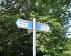
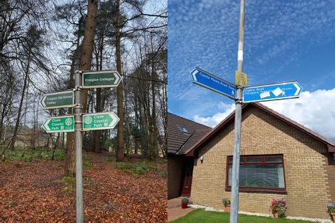
Like other parts of East Dunbartonshire, the Kirkintilloch area is well-signposted (at least 50 signs recorded in the audit). Rural and urban paths have signs helping people follow routes, understand where routes lead and how long it takes to reach destinations. Signs are commonly blue with approximate journey times and distances marked (pictured).
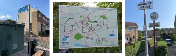
A problem in Kirkintilloch is damage to signs (7 instances recorded). Stickers, graffiti (pictured middle) and burns mean some signs are not fit for purpose. Auditors judged there to be 7 instances where signs were missing or would be helpful for people using the off-road network.
SWOT -
|
Strengths:
|
|
|---|---|
|
Weaknesses: |
|
|
Opportunities:
|
|
|
Threats: |
|
Lennoxtown
The Lennoxtown community area encompasses the towns and villages of Lennoxtown, Milton of Campsie, Clachan of Campsie and Haughhead. There is one significant off-road path in this area. The SRP uses disused rail infrastructure and now forms part of the national cycle network, NCN755 from Kirkintilloch to Strathblane. This path represents an important arterial route from which other paths can be accessed.
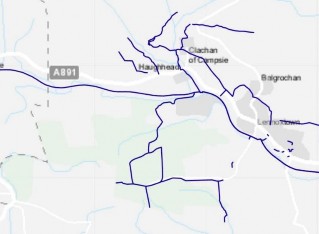
The western half of Lennoxtown area with off-road path network marked. Eastern Lennoxtown area (Milton of Campsie)
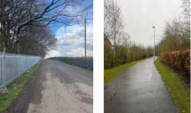
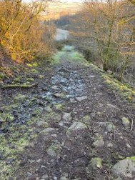
As well as an arterial long-distance path, the Lennoxtown area has urban and, for the most part, rural paths. These rural paths are generally only suitable for walkers and have quite low usage levels. The following picture is representative of a typical rural path in the area.
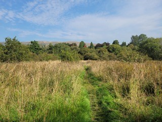
A path typical of rural parts of East Dunbartonshire and the Lennoxtown area in particular. This path is graded fair with a mud surface suitable for walkers.
- General comments
General comments received about Lennoxtown routes were detailed and varied. The route to Cort-ma Law in the Campsies has several general comments regarding how steep and narrow the route is, noting areas where the route is eroding the hillside and rocky sections.
Other general comments note areas of particularly poor, boggy conditions (near Ashenwell Dams), drainage issues (Milton of Campsie, among others) and places to rest (SRP, among others.
- Route information
|
Hard |
Dirt/mud |
Gravel/loose |
Road |
Grass |
|---|---|---|---|---|
|
13 |
7 |
6 |
1 |
8 |
SRP, east of Lennoxtown. Part of the national cycling network, this route was graded good (although it is poor in places, see maintenance issues section).
This route (pictured), from north Lennoxtown towards Milton of Campsie, is typical of a fair or good route for walkers. Obviously cycling and wheeling is not feasible for this route and, in rural areas, it is not necessarily an achievable or desireable aim to make all paths entirely accessible.
|
Very poor |
Poor |
Fair |
Good |
|---|---|---|---|
|
3 |
5 |
18 |
8 |
|
Walking |
Walking/Cycling |
Walking/Cycling/Wheeling |
n/a |
|---|---|---|---|
|
19 |
4 |
8 |
1 |
- Barriers
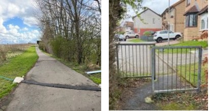
There are numerous barriers on the off-road active travel network in Lennoxtown. Some paths that could be suitable for walking, cycling and wheeling are made unsuitable due to these barriers. For example (pictured) where guard rails and an uncontrolled road crossing complicate mobility for those with limited mobility and children. There is another example of a path in Lennoxtown with a ramp designed to give access to wheelchairs but the ramp is too steep and slippery to provide genuine, easy access (pictured).
Barriers on rural routes include boggy, steep, narrow and rocky sections of path as well as gates and other obstacles that require a good level of mobility. In most cases these barriers are passable but some rural gates are becoming less stable due to rotting and water damage (north Lennoxtown-Milton of Campsie route) and other routes are boggy to the point of almost being unpassable (L3 towards Torrance).
- Cycle parking
No cycle parking was recorded on the off-road active travel network in Lennoxtown. There is, however, cycle parking for ten bikes at the Lennoxtown hub (Main Street) and a small number of spaces to park bikes at Clachan of Campsie.
- Maintenance issues
The SRP is notable for its amount of maintenance issues, with tree roots being particularly numerous and problematic for cyclists and wheelers. There are eighteen tree root damage instances on the path in Lennoxtown, three of which were flagged as serious. The picture is a moderate example of tree root damage, with some examples being more serious and extensive. There are also eight instances of overgrown vegetation impeding the path (pictured below middle).
Rural maintenance issues on paths intended for walking (of which there are many in Lennoxtown) are typically a less immediate concern than those on paths intended for walking, cycling and wheeling and urban/suburban paths that link residences with important services and amenities. Pictured is an example of an urban path in Lennoxtown that has serious maintenance issues which render the path difficult to use.
- Signage
The signage in the Lennoxtown area ranges from existing signage directing users of the network along paths or to certain places and sights to missing signage, damaged signage and signage intended to discourage people from travelling through and using spaces.
In total the audit found 28 existing signs in fair to good condition, four signs missing, three damaged and two old, redundant signs. Auditors reported that some signs required cleaning and greater prominence to be more visible to users, urban paths were lacking in signage and, although well-signed as a route itself, the SRP lacks signage pointing users towards the towns that the route passes.
Signs that discourage people from using East Dunbartonshire’s active travel network and open spaces are contrary to the aims of any Active Travel Strategy. Private property and no ball games signs were recorded in Clachan of Campsie and Milton of Campsie.
A blue sign typical of wayfinding signs for off-road active travel in the UK. Sign lists towns and estimated journey time for walking and cycling.
This sign reads private ahead, pointing walkers in another direction. This signage is inconsistent with typical signage for walkers and may lead walkers to believe they are trespassing.
This barely visible sign is faded and obscured by vegetation. It is an example of damaged signage.
- SWOT
|
Strengths:
|
|
|
Weaknesses:
|
|
|
Opportunities:
|
|
|
Threats:
|
|
Milngavie
Milngavie is the starting point of the West Highland Way, which finishes in Fort William. As well as the world-renowned West Highland Way, Milngavie has an extensive network of off-road active travel paths. There were almost 63 kilometres of off-road paths identified in the Milngavie area. These paths do not include footways, on-road cycleways or Milngavie’s pedestrianised town centre.
Milngavie town centre is pedestrianised though it is currently not permitted to cycle there. There is little to no signage on entering the pedestrian precinct to suggest that cycling is banned. Responsible cycling is feasible here and would improve the attractiveness of this sustainable mode of transport in Milngavie. There is some covered cycle parking at the southern end of the precinct but more is required throughout the town.
The West Highland Way contributes to the identity of the town and provides an arterial, off-road route for pedestrians and some cyclists to access Milngavie’s green spaces. The Clyde Coastal Path, another key long-distance route attracting visitors as well as providing opportunities for leisure for residents, leads to Milngavie after entering East Dunbartonshire from the west. Mugdock Country Park and the nearby Mugdock reservoir attract visits from locals as well as those from further afield. While it is possible to reach Mugdock Country Park from the town centre using off-road paths, the reservoir requires an on-road walk. Better pedestrian provision on this route would encourage people to reach the reservoir using sustainable modes of transport. The park’s location on the edge of the town means that it is important to consider how to encourage people to use sustainable modes of transport to reach the area.
While some off-road paths provide links between residences and local amenities, these paths could be more comprehensive, better maintained and more accessible. South of the town centre, Lennox Park offers access to Allander Water. 40 routes were audited in the Milngavie area.
- General comments
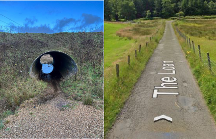
General comments highlight issues, infrastructure and characteristics of paths that are not accounted for in the other categories. General comments recorded in Milngavie included a tunnel (pictured below), educational signage and a slippery, rocky section of path on the Clyde Coastal Path which would make use of the path difficult for those with impaired mobility. Closer to Milngavie town, there were other issues with the Clyde Coastal Path where signage was unclear and contradictory and the path followed the route of a very narrow country road which put active travellers in some danger due to traffic.
Other general comments included where off-road paths go on-road, rocky sections, muddy sections and where paths had unexpected dead ends.
- Route information
The route information section of the network audit provides data about the surface, condition and possible users of each path. The following tables show information about Milngavie’s 40 audited routes and the pictures indicate what each category looks like in reality.
|
Hard |
Dirt/mud |
Gravel/loose |
Road |
Grass |
Boardwalk |
|---|---|---|---|---|---|
|
24 |
8 |
7 |
2 |
4 |
1 |
Pictured is a hard, off-road path for walking, cycling and wheeling graded good in Milngavie. Pictured in midsummer, vegetation provides a minor barrier to active travel and requires maintenance.
|
Very poor |
Poor |
Fair |
Good |
Very good |
|---|---|---|---|---|
|
1 |
8 |
17 |
16 |
0 |
|
Walking |
Walking/Cycling |
Walking/Cycling/Wheeling |
|---|---|---|
|
16 |
10 |
12 |
- Barriers
The Milngavie off-road active travel network has numerous barriers which impede certain modes of active travel and prevent certain people from using the network. It is more important to avoid obstructions in accessible urban areas rather than in rural areas where gates (pictured), stiles, walls and bridges (5, all in good condition) are common. Milngavie’s off-road network, in urban areas, is reasonably accessible and obstacle-free. The pedestrianised town centre is highly accessible, free of obstructions and well-equipped with amenities and street furniture. Paths between the town centre and residential estates, on the other hand, are less consistently accessible. They commonly feature uncontrolled road crossings (10 recorded, including several lacking dropped curbs) and steps (at least 12). These features of the built environment represent significant barriers to the mobility of those with disabilities.
At the popular Milngavie reservoir, narrow bridges present barriers to wheelchair users and people with prams (pictured). Uncontrolled road crossings are, like elsewhere in East Dunbartonshire, a risk for those using the off-road active travel network. This one (pictured) east of Milngavie was particularly dangerous due to a fast road and a corner which impeded visibility.
- Cycle parking
Apart from some high-quality, covered cycle parking near the pedestrianised town centre, there is very little cycle parking close to Milngavie’s off-road active travel network. The two pieces of existing infrastructure are limited and poor quality (i.e. not Sheffield stands). There is an opportunity to provide increased cycle parking in Milngavie. If it were targeted particularly around Mugdock Park and the reservoir, it would encourage people to reach these popular destinations by bike.
- Maintenance issues
The urban paths and sections of long-distance paths within Milngavie town are broadly in good condition. However, sections of the Clyde Coastal Path close to the boundary with Glasgow City Council are in poor condition (almost to a dangerous level when slippery). On urban paths, a pressing maintenance issue (as in Lennoxtown and Kirkintilloch) is tree root damage which impedes cyclists, wheelers and those with restricted mobility.
- Signage
Signage on long-distance routes and in Mugdock park is comprehensive and helpful. There are sections of the Clyde Coastal Path that could be more clearly signposted to aid navigation.
Milngavie town centre is reasonably well signposted and some signs provide an estimated walking time.
The network audit recorded several places where signage was damaged (mostly from graffiti, stickers as pictured below, falling or being obscured by vegetation.
- SWOT
|
Strengths:
|
|
|---|---|
|
Weaknesses:
|
|
|
Opportunities:
|
|
|
Threats:
|
|
Torrance
Torrance is not a densely populated area and, aside from several paths in Torrance, two through Balmore and one through Bardowie, most paths are rural, difficult to access without a car and therefore not useful for everyday journeys.
The residential areas in Torrance have the basis of a good off-road pedestrian network, the east side of the town has particularly good active travel connections towards the primary school, nursery and town centre. Balmore and Bardowie have paths connecting to rural areas but are largely connected to other towns by fast, rural B-roads.
The off-road network of paths in Torrance, Torrance village is located in the middle on the right of the above map
Despite its proximity to Bishopbriggs, there is no logical, direct route south from Torrance to Bishopbriggs.
- General comments
Two general comments were recorded; a rural route was a driveway leading only to someone’s house and pavement surfaces near an off-road route were particularly poor in Torrance.
- Route information
Many of Torrance’s rural paths are in poor condition, more so than other parts of East Dunbartonshire. Several of these paths in poor or very poor condition are remote, inaccessible and don’t lead to any points of interest.
|
Hard |
Dirt/mud |
Gravel/loose |
Grass |
|---|---|---|---|
|
8 |
2 |
4 |
4 |
|
Very poor |
Poor |
Fair |
Good |
|
5 |
3 |
3 |
6 |
|
Walking |
Walking/Cycling |
Walking/Cycling/Wheeling |
|---|---|---|
|
5 |
2 |
6 |
As the picture shows, there were several routes labelled on the map in Torrance that were inaccessible due to either a lack of access or poor condition.
There was a difference in the condition of urban and rural paths in Torrance. Within Torrance, paths were mostly graded good with three exceptions while outside Torrance only one path was graded good.
- Barriers
Like all rural paths, there were many gates (fourteen recorded, pictured is a typical gate for rural paths around Torrance).
Other barriers recorded were overgrown vegetation (three), an uncontrolled crossing in Balmore with particularly poor visibility, no access, steps (three) and good-quality cycle parking
No cycle parking was recorded in Torrance.
- Maintenance issues
The route information data in Torrance suggests significant maintenance issues in the area. That said, most of the paths are rural and not well-used. It would be a better use of resources to focus on well-used urban paths with maintenance issues that exclude some people from using the active travel network, such as this surface damage pictured in Torrance.
In Torrance, there was surface damage (one serious, six moderate and three minor). Notably, there were recent repairs to surfaces on paths that had made problems worse (pictured).
- Signage
Signage in Torrance is typical of the area as a whole. Notably, there were five recorded healthy habits signs with cycling journey times to nearby points of interest and towns (pictured below).
- SWOT
|
Strengths:
|
Urban network in Torrance provides a strong foundation for connecting town centre, key amenities and green space with residential areas. Rural network connecting towns exists but requires significant upgrading. |
|---|---|
|
Weaknesses:
|
Poor condition and accessibility of rural network. Urban network needs more comprehensive signage; some sections in poor condition and recent maintenance work has been poor. Poor connections to nearby town of Bishopbriggs. |
|
Opportunities:
|
Better connections to Bishopbriggs would enable access to good quality train service to Glasgow and Edinburgh. Better active travel to public transport more generally to reverse car dominance. |
|
Threats:
|
Poorly maintained paths and missing links between towns reinforcing car dominance. Poor lighting on urban paths means they are only useable in daylight. |
Conclusions
The network audit was a useful exercise to understand the extent, condition and features of East Dunbartonshire’s off-road active travel network. It revealed some strengths and weaknesses of the network as a whole.
Strengths:
- Provides access to greenspace, areas of natural beauty and points of interest. In this respect, the off-road network in East Dunbartonshire plays an important role in providing opportunities for leisure and physical exercise.
- In some cases, the off-road network facilitates faster, more direct journeys by active travel than by car.
- Good signage, particularly on long-distance paths for leisure journeys.
Weaknesses:
- Off-road network largely unlit, if it is lit it often lacks the levels of passive surveillance required to provide an environment perceived as safe enough to use during hours of darkness. This means the urban off-road network is not fully capable of meeting people’s needs for everyday journeys.
- Inequality of access: the network is more comprehensive and in better condition in parts of Bearsden and Milngavie compared to parts of Lennoxtown, Hillhead and Auchinairn.
Opportunities:
- Routes that allow faster, more direct journeys than the car require upgrading to ensure everyone has access and better signage to ensure people understand that it can be quicker and easier to use active travel than the car. This will improve modal shift for active travel in East Dunbartonshire.
- Improving understanding of how off-road network links with key on-road footways to ensure there is a consistent standard which enables equal access to amenities.
Weaknesses:
- Maintenance issues mean, in some cases, access is restricted for those with limited mobility.
- Signage illustrating how the network links key amenities for everyday journeys is sometimes lacking.
- A weakness not of the network but the methodology of the audit was its focus on the off-road network. The most used paths for active travel are footways and roads. A future audit of how this infrastructure supports active travel would help form a complete picture of active travel in East Dunbartonshire.