On this page you will find information on:
- Introduction
- Site Location
- Site Boundary
- Mugdock Country Park
- Management Compartments
- 1998 Integrated Management Plan
- Key Site Features
- IMP Management Objectives
- The Masterplan Milngavie
- Mugdock Country Park Masterplan
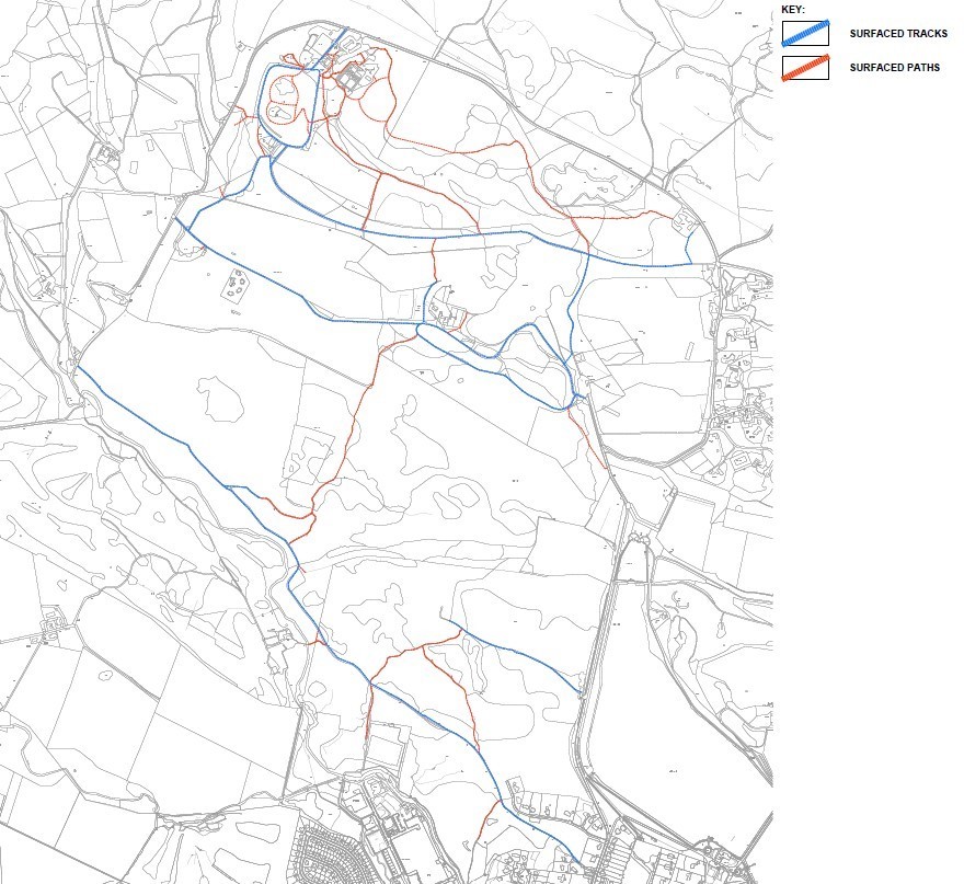
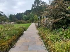
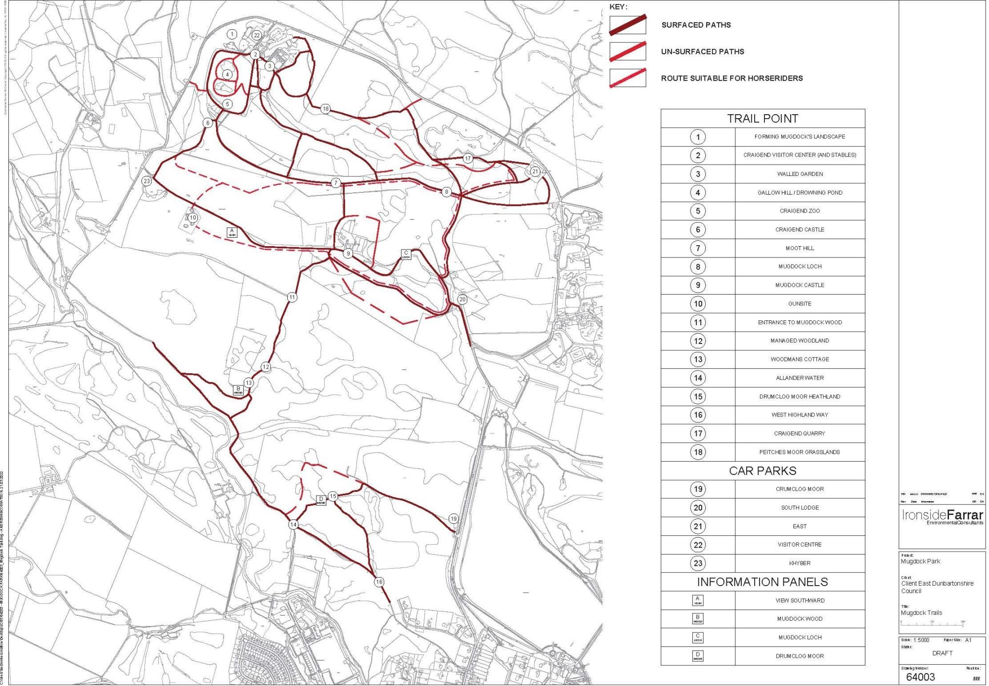
- Access Routes
- Need for an updated Land Management Plan
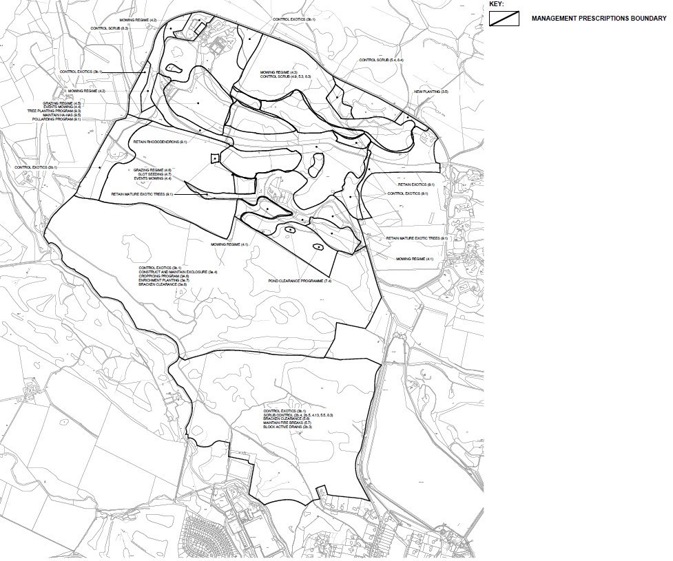
- Management Prescription Boundaries
- Vision, Aims and Strategic Objections
- Site Audit Works
- Management Prescriptions
- Roles and Responsibilities
- Appendix 1 - Site Audit Maps
- Appendix 2 - Funding Opportunities and Resources
- Appendix 3 - Report Maps
1.0 Introduction

The Mugdock Country Park: Integrated Management Plan (1998-2003) was produced by Heritage Environmental Ltd in 1998 in accordance with the Nature Conservancy Council's (NCC) guide to management plans (NCC 1988) and with addictions necessary to take account of MCPs landscape, cultural and amenity interest.
This Land Management Plan complements the original Integrated Management Plan and includes Land Management proposals which arise through the adoption of a new Mugdock Country Park Strategy & Masterplan. It therefore includes additional recommendations including elements which seek to address the needs of communities today and having a role and contribution to the key challenges of our time:
- Health & Well Being
- Active Communities
- Free Recreational Access – Inclusion/Exclusion resulting from Poverty
- Biodiversity
- Education
- Green / Blue-Green Networks – connected places
- Climate Change
- Place Quality / Valued Places
- Empowered Communities
This Land Management Plan sets out the Vision, Aims, Objectives and specific management for each of the main compartments and sub compartments. These compartments and sub-compartments are the same as those referred to in the Heritage Environmental Integrated Management Plan for ease of reference.
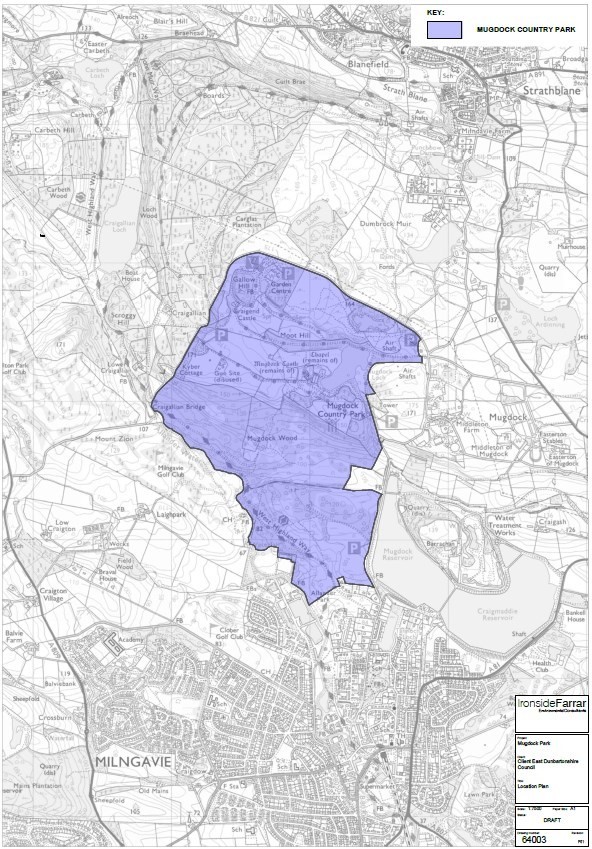
Map 1 Site Location
Click on image to enlarge
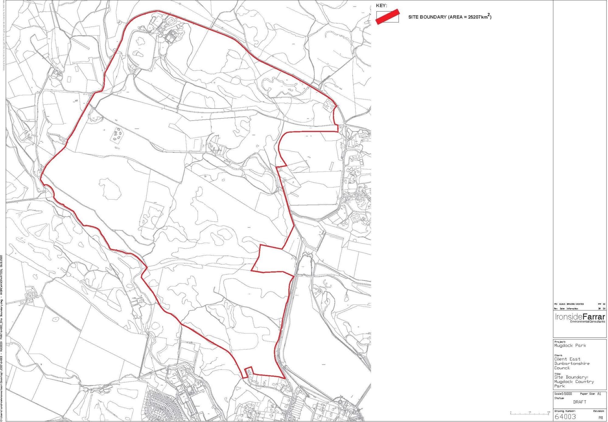
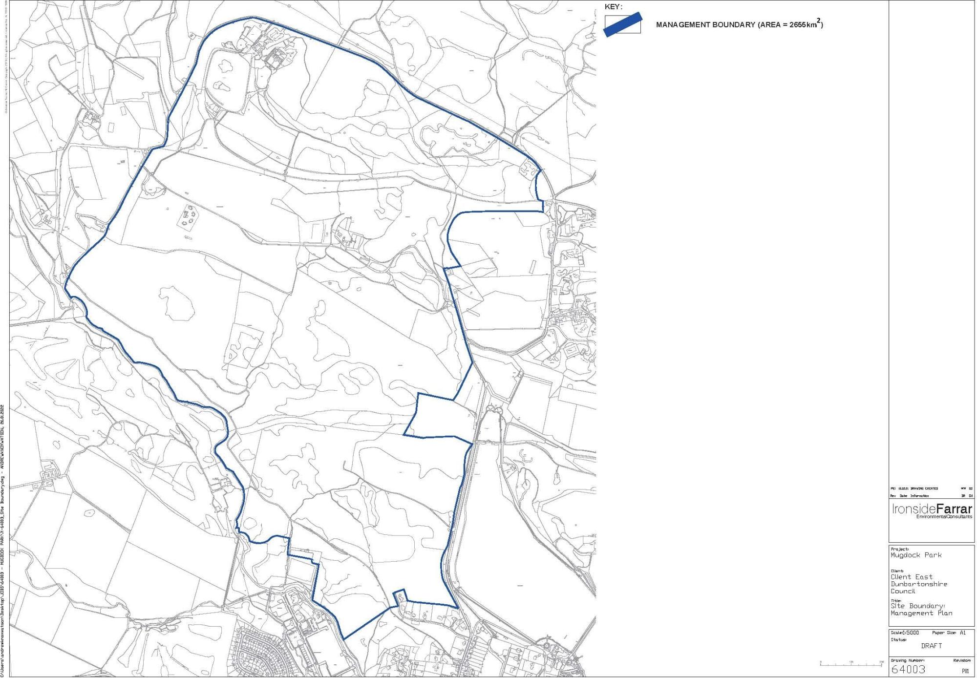
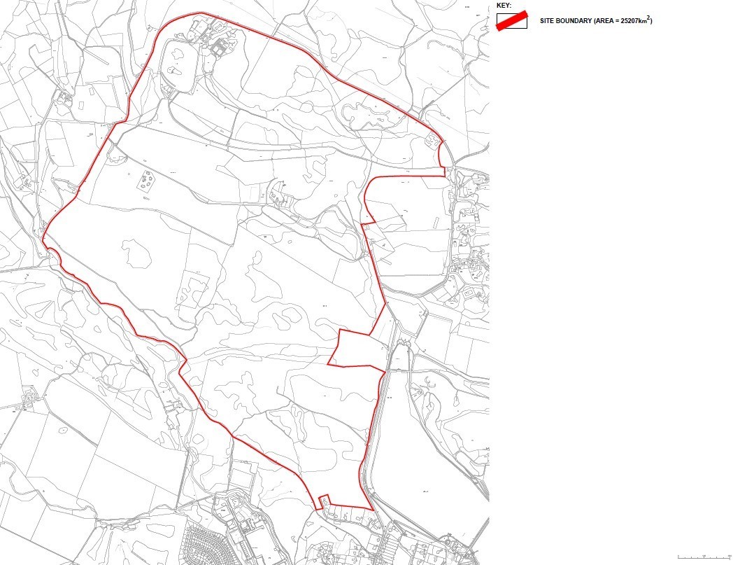
Map 2 Site Boundary
Click on image to enlarge
2.0 Mugdock Country Park
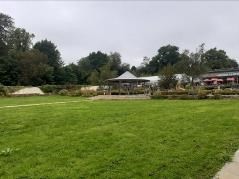
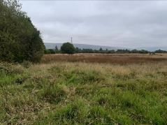
Mugdock Country Park is a major community asset in the Green Network of East Dunbartonshire & Stirling. The facility extends over 260ha of environmental greenspace asset including the SSSI site with a range of attractions and supporting facilities. The lands were gifted in 1982 by Sir Hugh Fraser for the ‘sole purpose of providing a country park for the recreation and pleasure of the general public’.
Visitor numbers to Mugdock Country Park and the adjacent area were at an unprecedented level during 2020 highlighting existing vehicular and pedestrian pressures on the landscape and its neighbouring road infrastructure. The Country Park comprises a number of key parts:
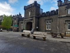
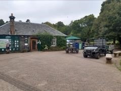
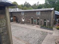
- The Stables Visitor Centre & associated facilities
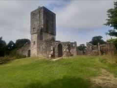
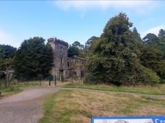
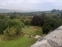
- Mugdock Castle
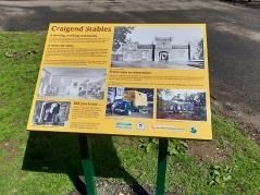
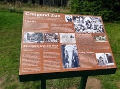
- Craigend Castle
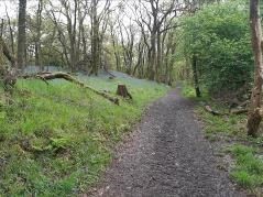
- Mugdock Wood / SSSI
- Walled Garden
- WWII Gunsites
The aspiration for Mugdock Country Park’s future is that all these constituent parts work together and with their adjoining communities to increase the overall visitor offer. East Dunbartonshire and Stirling Council ‘s are planning investment in the management and maintenance of Mugdock over the next 5 years to ensure a high quality, accessible and sensitively developed destination of choice for our residents and visitors.
East Dunbartonshire and Stirling Council ‘s are seeking to ensure the park remains fit for purpose and delivers the widest possible benefits for its communities and stakeholders and has commissioned this study to develop a clear strategy and investment led masterplan to regenerate and direct future investment in the Country Park.
Mugdock needs to transform itself from the 1970’s concept of a designated location for near countryside activity to a modern 21st century Country Park to best continue its role in the future of its surrounding communities.
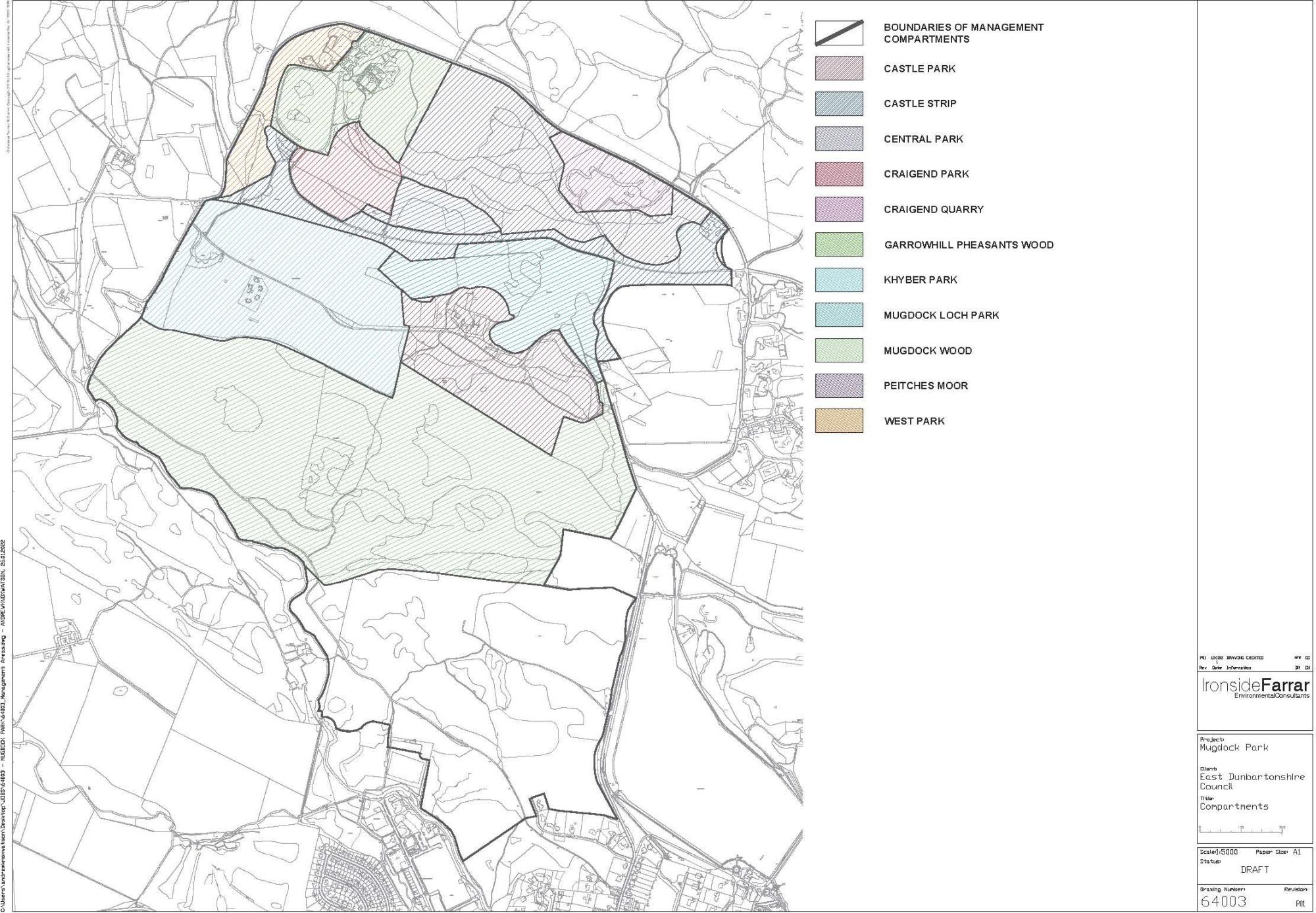
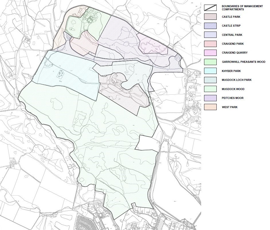
Map 3 Management Compartments
Click on image to enlarge
3.0 1998 Integrated Management Plan
for Mugdock Country Park (MCP) aimed at providing a working document for day-to-day management and works throughout the whole of the Park.
The document brought together the previously prepared management plans for the three sections of the Park comprising Mugdock Wood and Drumclog Moor (Keith Watson, 1996 & 1997) and the northern section of the Park (K.E. Hutcheon & M.A. Bates, 1998, Heritage Environmental Ltd).
The area included within the plan covered the whole of MCP and the whole of Mugdock Wood SSSI. Part of the SSSI lies outwith the Park but was included in the integrated plan following its inclusion in the Drumclog Moor Management Plan, 1997
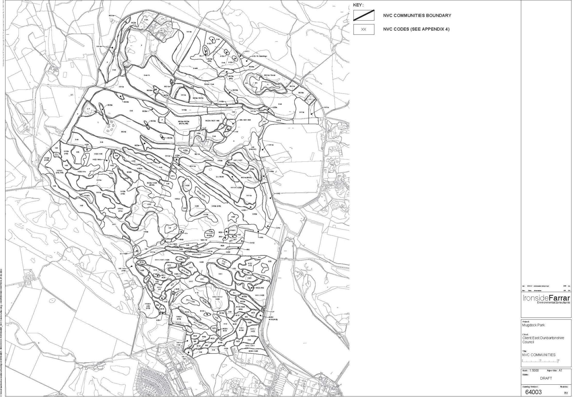
The IMP split the site into a series of main and sub-compartments and provided a detailed description of each of these areas in terms of species mix / planting type / age composition / stocking and outline proposals for management, including planting / thinning / brash clearance and more general safety survey of trees in areas of greater public access e.g. at the sides of paths, roadside and boundary planting.
The IMP also set out a series of more general management recommendations. The recommendations have formed the basis of works implemented by EDC as part of management of the Country Park in the period since.
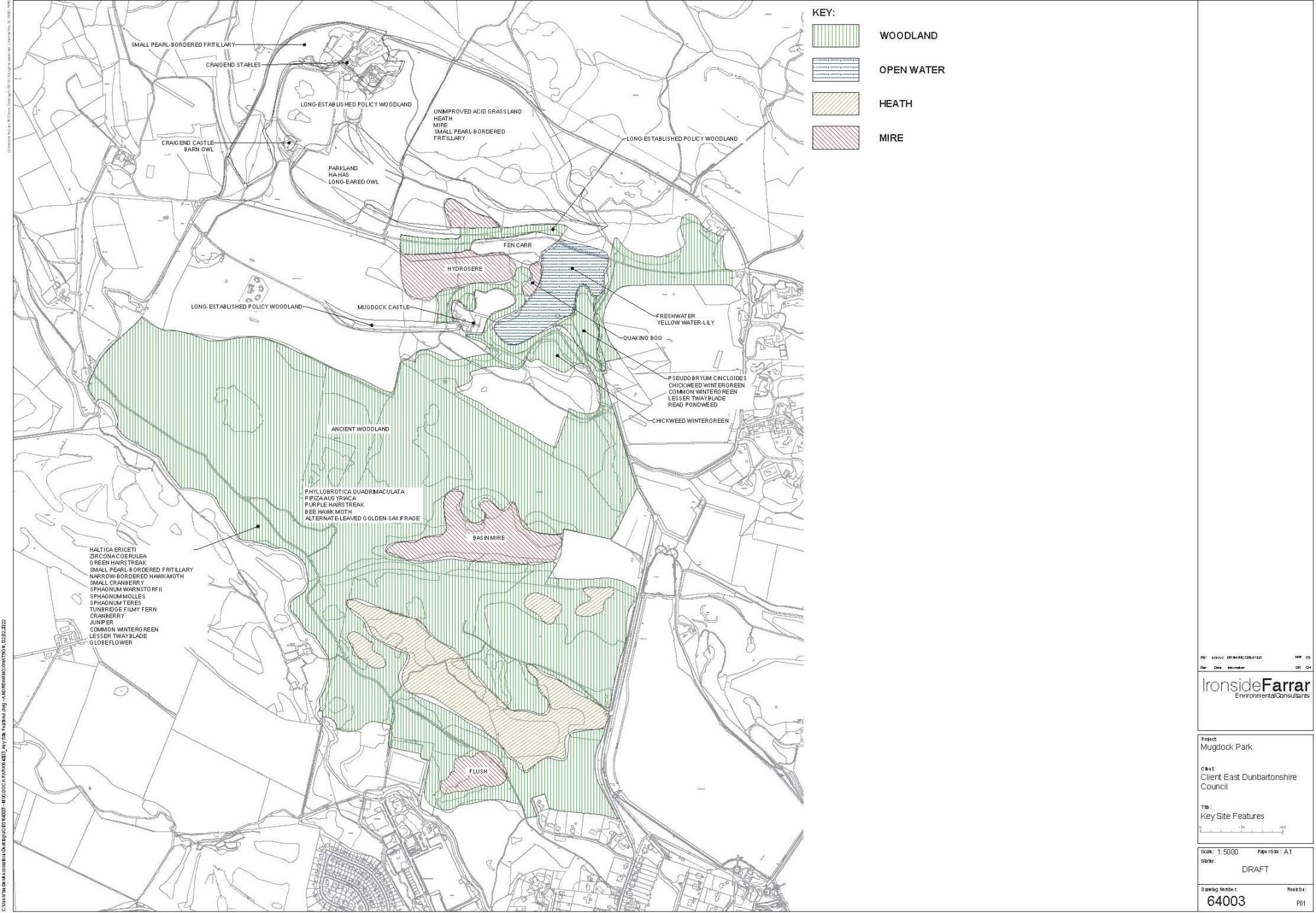
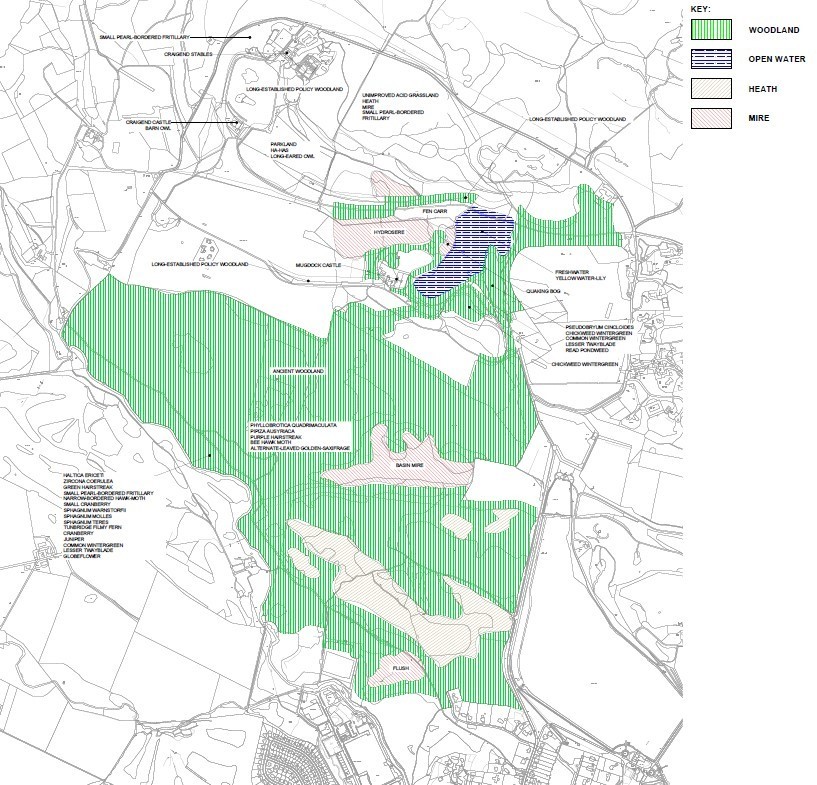
Map 4 Key Site Features
Click on image to enlarge
4.0 IMP Management Objectives
Consideration of the Site Description, Evaluation and Factors Influencing Management allowed the identification within the original IMP of the ideal management objectives for Mugdock Country Park. These objectives are not ranked or necessarily of equal importance.
- To safeguard Mugdock Wood SSSI, by ensuring compliance with all legal/other obligations.
- To maintain and enhance the semi-natural mire and swamp.
- To maintain and enhance the semi-natural woodland.
- To maintain and enhance the semi-natural grassland.
- To maintain and enhance the semi-natural heath.
- To maintain and enhance the bare rock habitats.
- To maintain and enhance the open water habitats.
- To maintain and enhance flora and fauna populations of key species.
- To maintain and enhance cultural landscapes and associated features.
- To maintain and enhance amenity/recreation facilities.
- To maintain and enhance historic and built features.
- To undertake monitoring to ensure the integrity of key features and to assess the effectiveness of management actions.
- To continue with site-based research and survey in order to identify the full range of natural heritage features and to underpin management.
- To develop and promote opportunities for visitor education and understanding.
- To ensure that management activities, survey or research activities on site are properly and safely planned, implemented and recorded.
These long established Management objectives are still seen as the guiding elements for management of MCP now and in the future.
The Masterplan Milngavie
Click on image to enlarge
5.0 Mugdock Country Park Masterplan
A park of choice, of heritage, a park for everyone - a place of natural inspiration—MCP Vision
The Mugdock Country Park Strategy is a transformational plan to recognise and celebrate Mugdock’s heritage and protect its natural environment. The remodelled park will be built around a more inclusive, multi-user community appeal, capable of retaining and better serving its visitors. Mugdock is a valued and valuable asset. It delivers key elements of both SC & EDC Strategies and supports key elements of the Scottish Government’s ‘Live-Learn- Work-Invest-Play’ vision. As an established Country Park, it has significant pressure to become an attractive regional destination.
A Place for Communities themed on Heritage and Nature
The Masterplan promotes Mugdock as a place for all, a place to enjoy, and a place full of special and authentic experiences hosting a wide range of activity. The goal of the Masterplan and overall management of Mugdock is to develop a destination that has strong and distinctive brand identity. The Masterplan recommends this is developed around heritage and the natural environment supported by a range of play and exploratory experiences across the natural landscape of the Country Park. Facilities need to be ‘best-in-class’ at a Scottish level and capable of providing the driver for visitor footfall, increased dwell time and repeat visits.
New Facilities
A new welcome and arrival experience will strengthen site orientation and wider signage and infrastructure connections to communities will reduce car dependency for visitors. Active travel and healthier lifestyle opportunities, including contact with natural environments, trees and woodlands, and playful elements of public art build a range of experiences and activities within the Country Park that has broad appeal. Focusing activity around the ‘Stable Hub’ combines the Country Park, Ranger and retail facilities to drive efficiencies and benefits, both for operational management and the customer experience. An enhanced network of barrier free paths with signage, waymarking and interpretation will enhance the experience for all users.
Investment for the Future
Investment requirements will be supported by grants and partnership funding, however a significant capital programme of £3+million is required. This will ensure that Mugdock Country Park can deliver strong sustainable and inclusive outcomes for both East Dunbartonshire & Stirling and their communities for this and future generations.
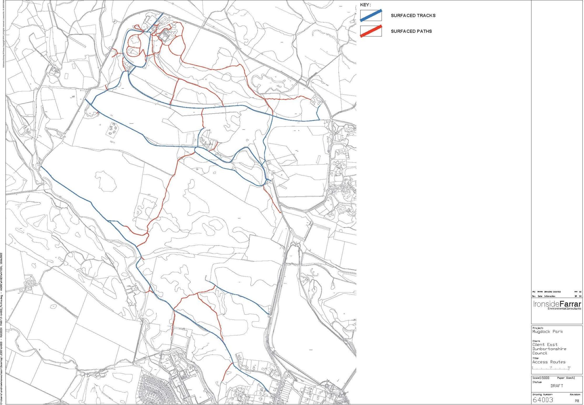
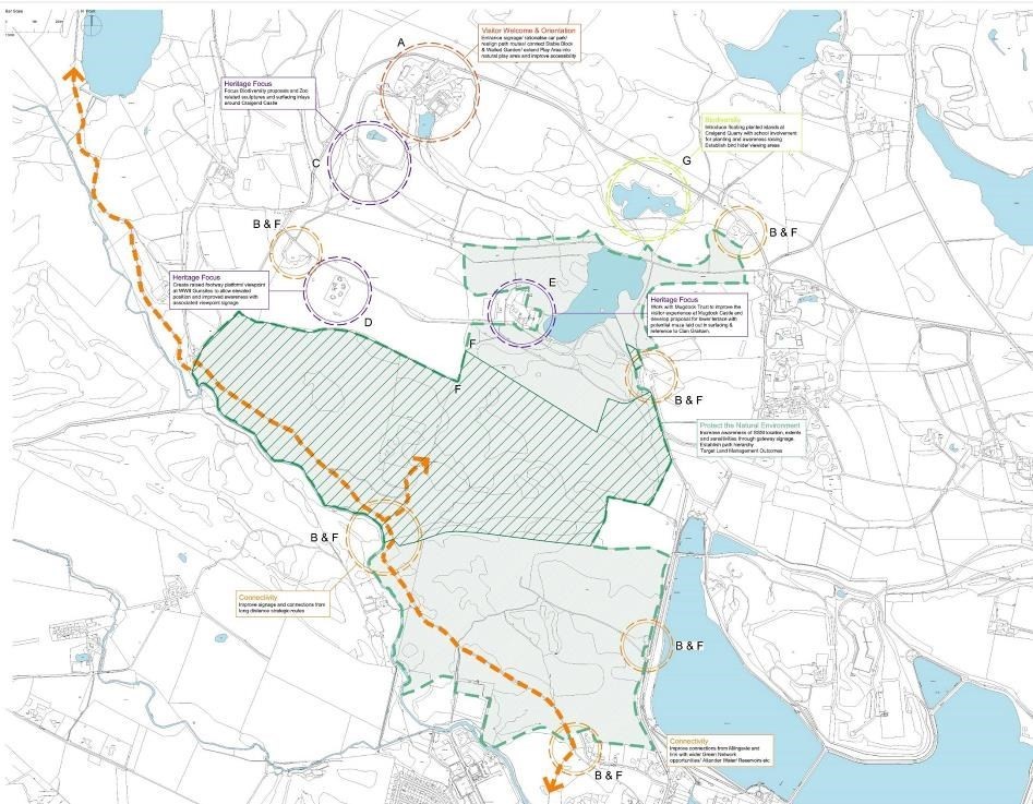
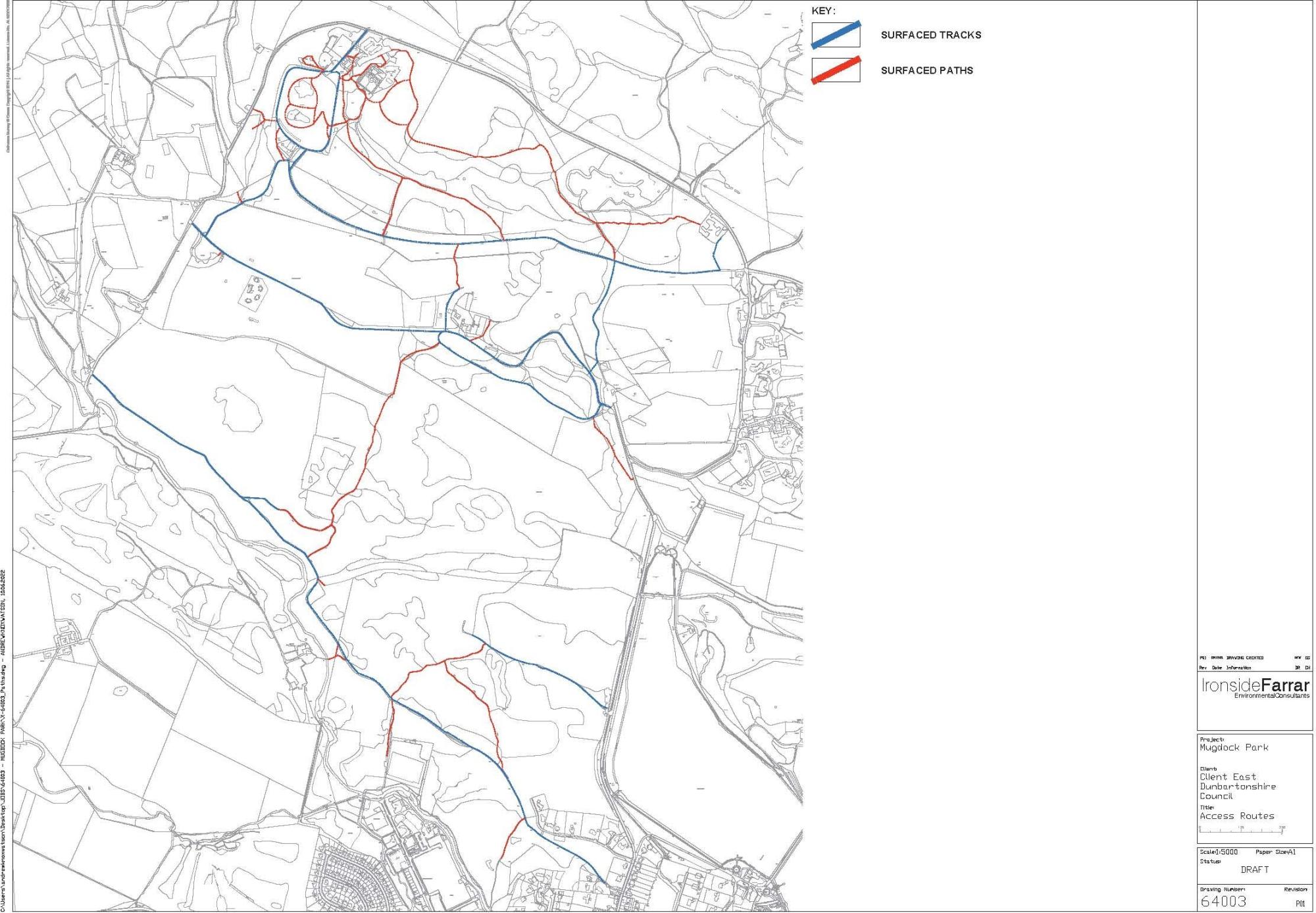
Map 5 Access Routes
Click on image to enlarge
6.0 Need for an updated Land Management Plan
Part 1 of the 1998 Integrated Management Plan contains site status, character, history, background and extensive site description. This Land Management Plan sits alongside this previously undertaken work and includes additional / alternative Management proposals which arise through the adoption of the new Mugdock Country Park Masterplan. It therefore includes wider recommendations including elements which focus on:
- Health & Well Being
- Active Communities
- Free Recreational Access – Inclusion/Exclusion resulting from Poverty
- Biodiversity
- Education
- Green / Blue-Green Networks – connected places
- Climate Change
- Place Quality / Valued Places
- Empowered Communities
General Land Management includes opportunities for biodiversity / protected species / priority habitats. This Land Management Plan sets out the Vision, Aims, Objectives and specific management required under each management objective as previously identified within the IMP.
Liaison with NatureScot has highlighted a need to focus on key aspects of the site to protect the SSSI. Currently the Site Management Statement notes areas of decline. Management measures to mitigate against this are included with the Land Management Plan.
|
Natural features of Mugdock Wood SSSI |
Condition of feature (date monitored) |
|---|---|
|
Upland oak woodland |
Unfavourable, declining (March 2008) |
|
Wet woodland |
Not yet monitored |
|
Mesotrophic loch |
Unfavourable, declining (July 2004) |
|
Lowland dry heath |
Unfavourable, recovering (July 2007) |
|
Lowland wet heath |
Unfavourable, recovering (July 2007) |
|
Beetle assemblage |
Favourable, maintained (March 2002) |
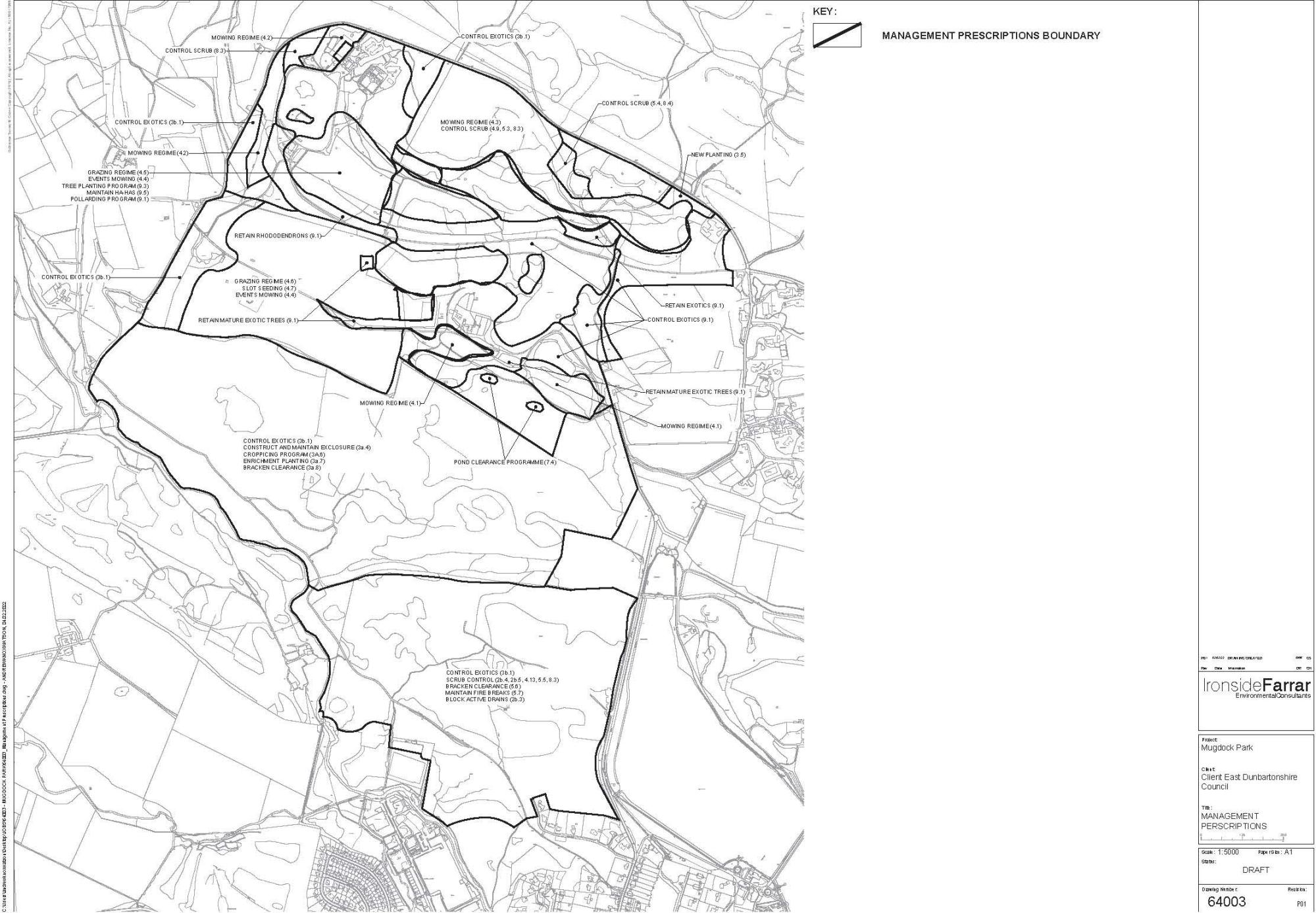
Map 6 Management Prescription Boundaries
Click on image to enlarge
7.0 Vision, Aims and Strategic Objections
Vision
The overall vision for Mugdock Country Park is for the management and development of multi-purpose, structurally and ecologically diverse, sustainable woodlands within the setting and context of the Country Park.
Aims of the Land Management Plan
- To align with the established programme of management works and seek opportunities identified within wider area policies.
- To identify and capture additional opportunities relating to acknowledged site assets
Strategic Objectives
As defined within local Green Network Strategies and Local Biodiversity Action Plans management at Mugdock will seek to meet Strategic area wide objectives:
- Safeguarding biodiversity
- Mitigating and adapting to Climate Change
- Supporting Sustainable Communities
- Supporting a Sustainable Economy
Mugdock Country Park is noted in both of East Dunbartonshire Council’s documents as being a key local resource for future protection and enhancement.
The ambition for East Dunbartonshire Green Network :
East Dunbartonshire is an attractive place to live, work and visit. Its built and natural environment improves the quality of lives, supports wellbeing and safe active travel, enables sustainable economic growth, improves connectivity and allows nature to flourish.
Stirling Council’s Alive with Nature Plan 2021-2045 sets a clear Vision that places Nature at the Heart of life—Here and Now. It aims to transform the Stirling area into Scotland’s greenest region, where our thriving natural environment is enjoyed and valued by everyone.
|
Safeguarding Biodiversity |
Mitigating and Adapting to a Changing Climate |
Supporting Sustainable Communities |
Supporting a Sustainable Economy |
|---|---|---|---|
|
Sustainable management and enhancement of the parks natural assets through an agreed land management plan.
|
Developing sustainable access to the park.
Exploring options to utilise green infrastructure within park projects – e.g. green walls, green roofs. |
Improving the educational resource through establishing of a forest school.
Enhancing the visitor experience.
Responsible enjoyment through promoting an understanding and appreciation for the park. |
Continuing to provide space and opportunities for local, sustainable businesses.
Developing further ideas for sustainable economic activity such as Mugdock Honey and Wildflower Nursery. |
Click on images to enlarge
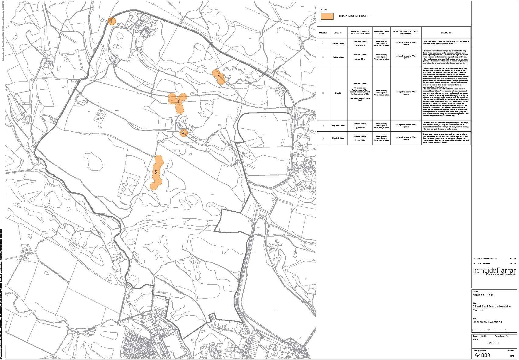
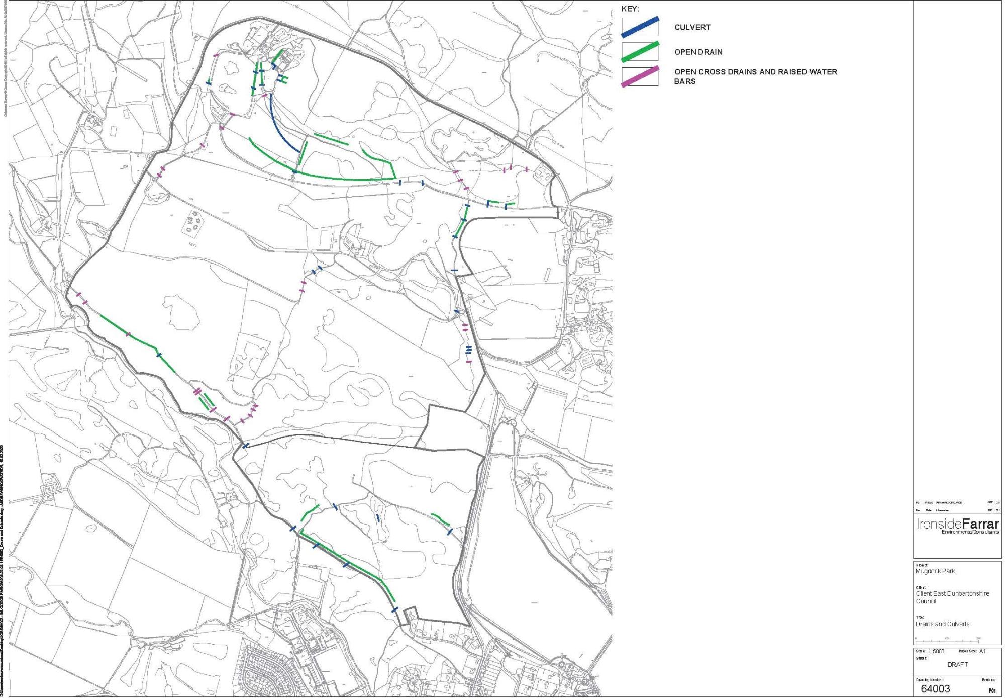
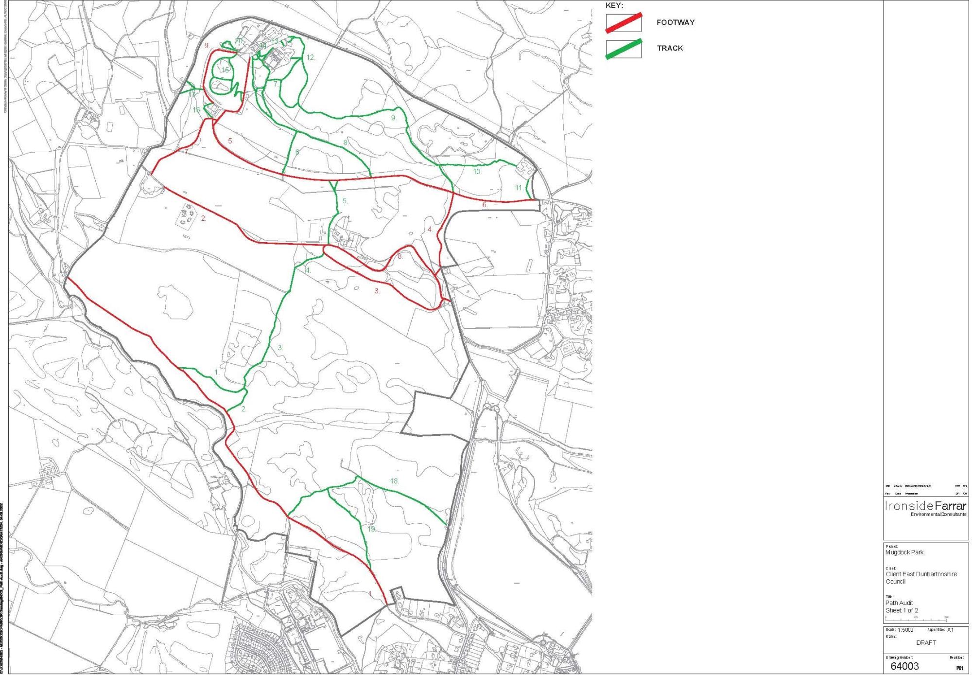
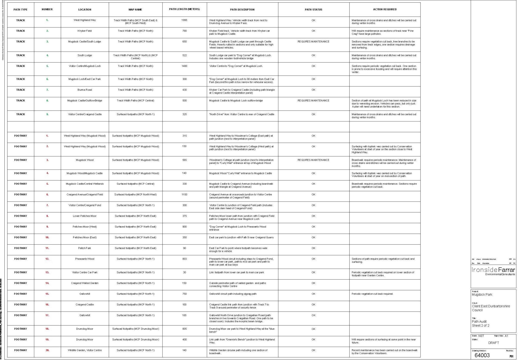
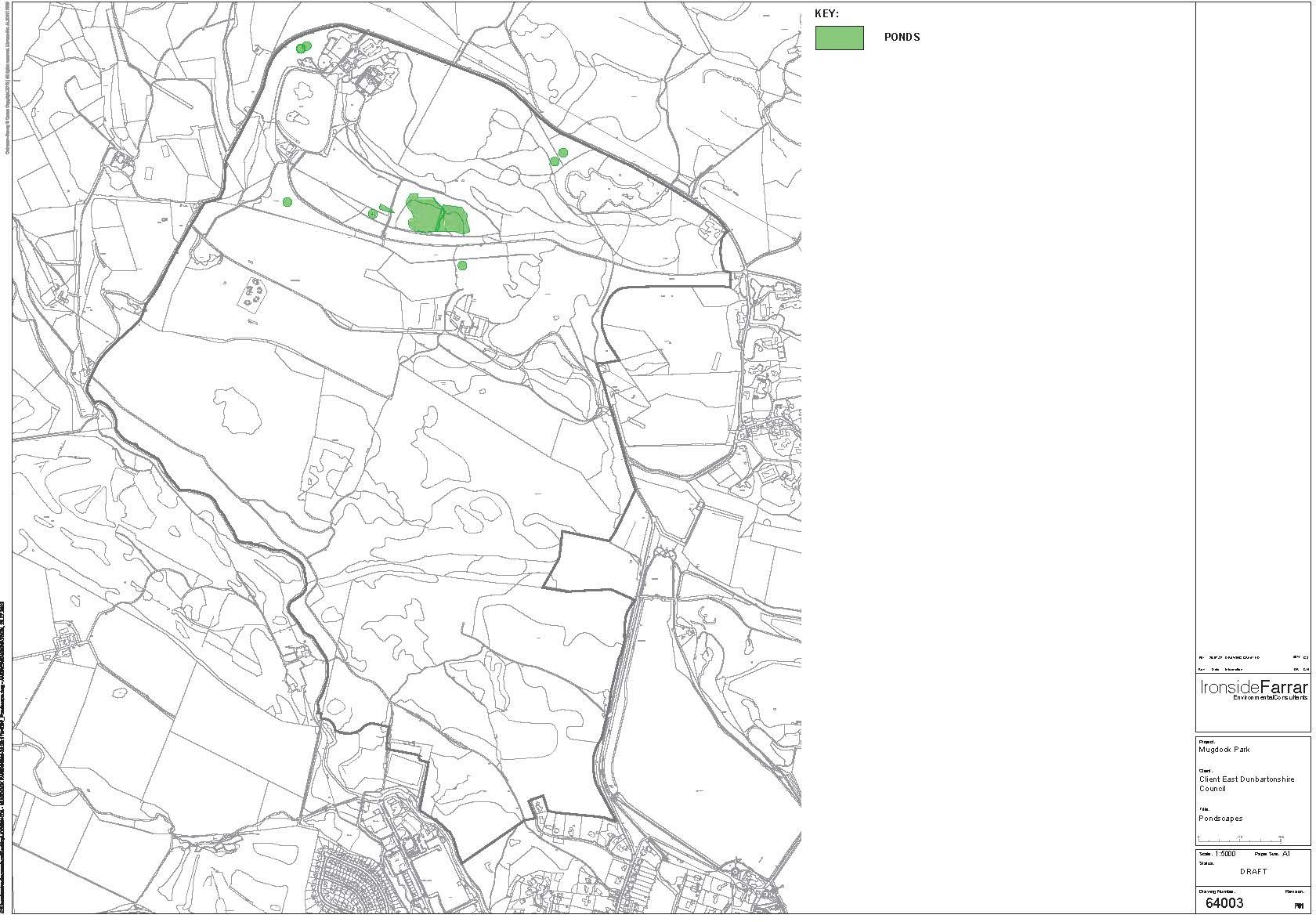
8.0 Site Audit Works
To establish a clear baseline for future management and maintenance of the Country Park resource a series of audits have been undertaken by the MCP Ranger team and mapped as GIS datasets.
Audit works undertaken are as follows:
- Boardwalk locations
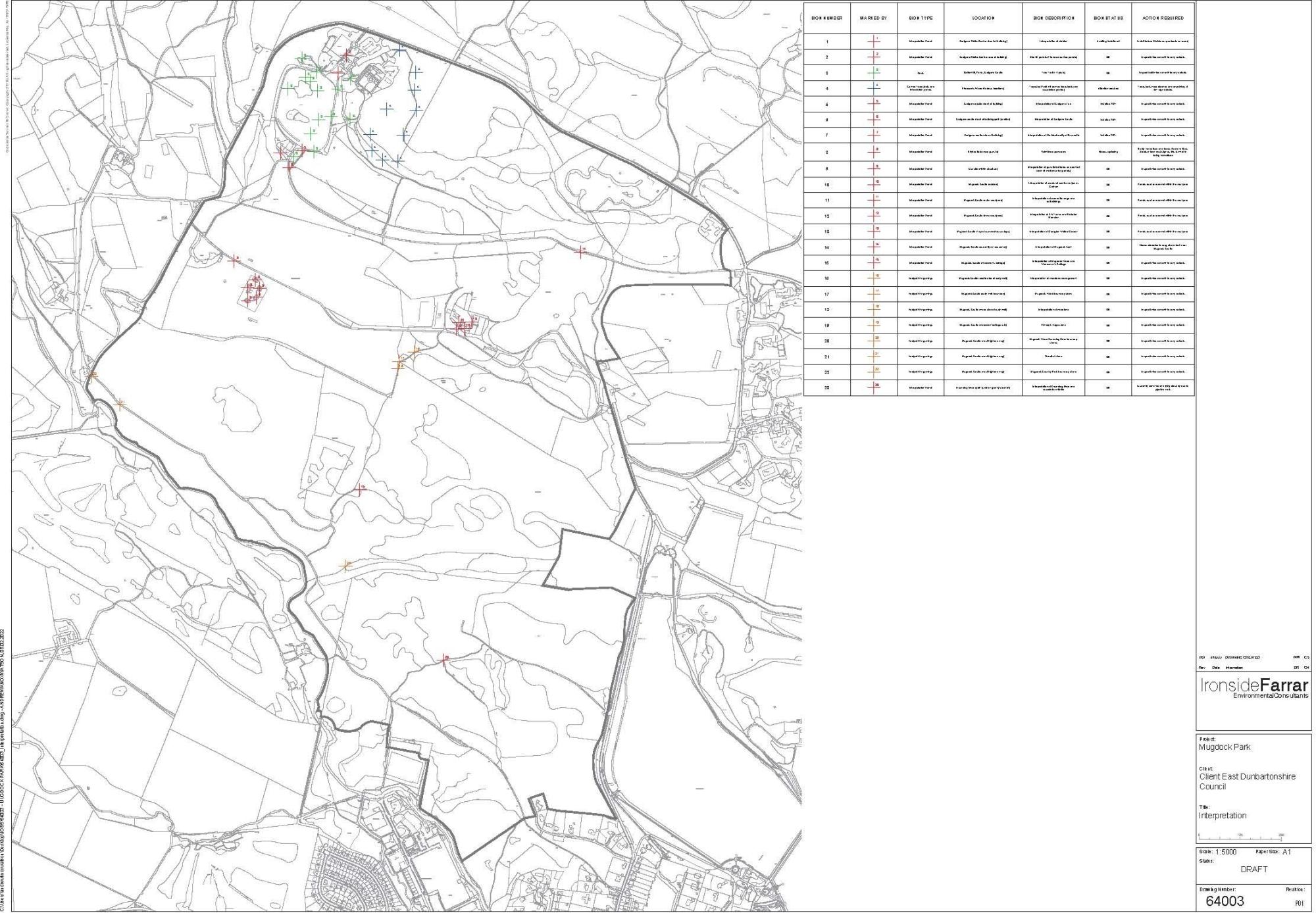
- Interpretation
- Drains and culverts
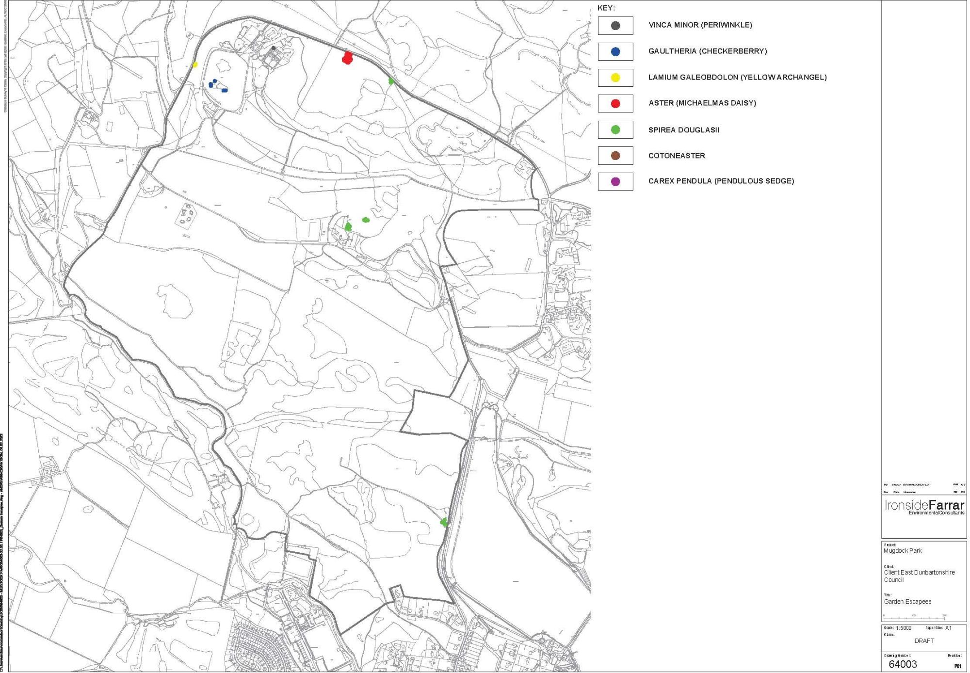
- Garden Escapees
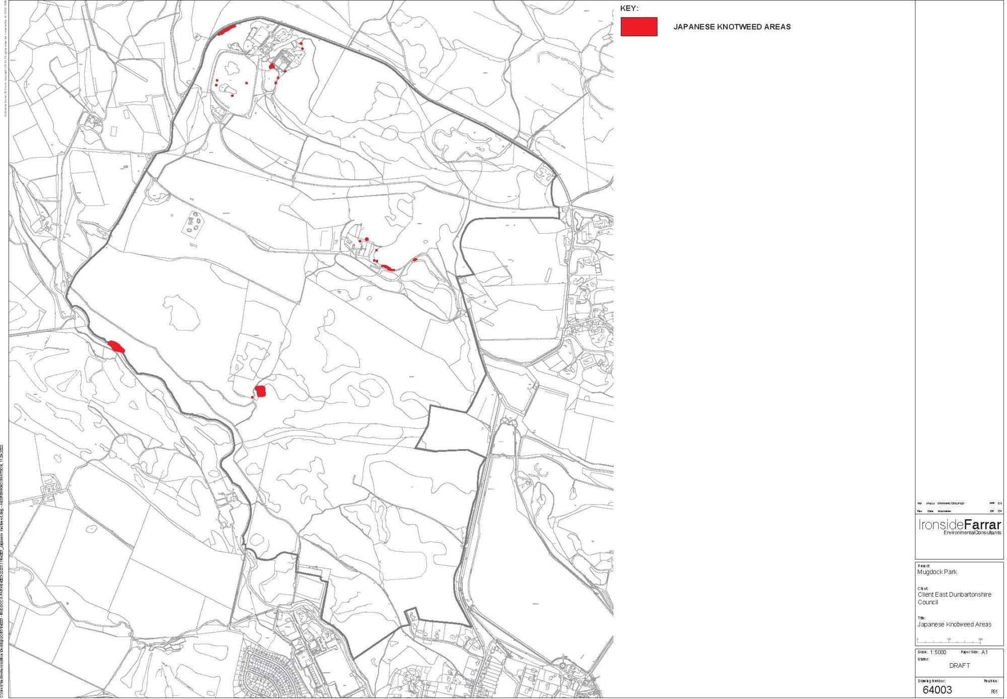
- Japanese Knotweed
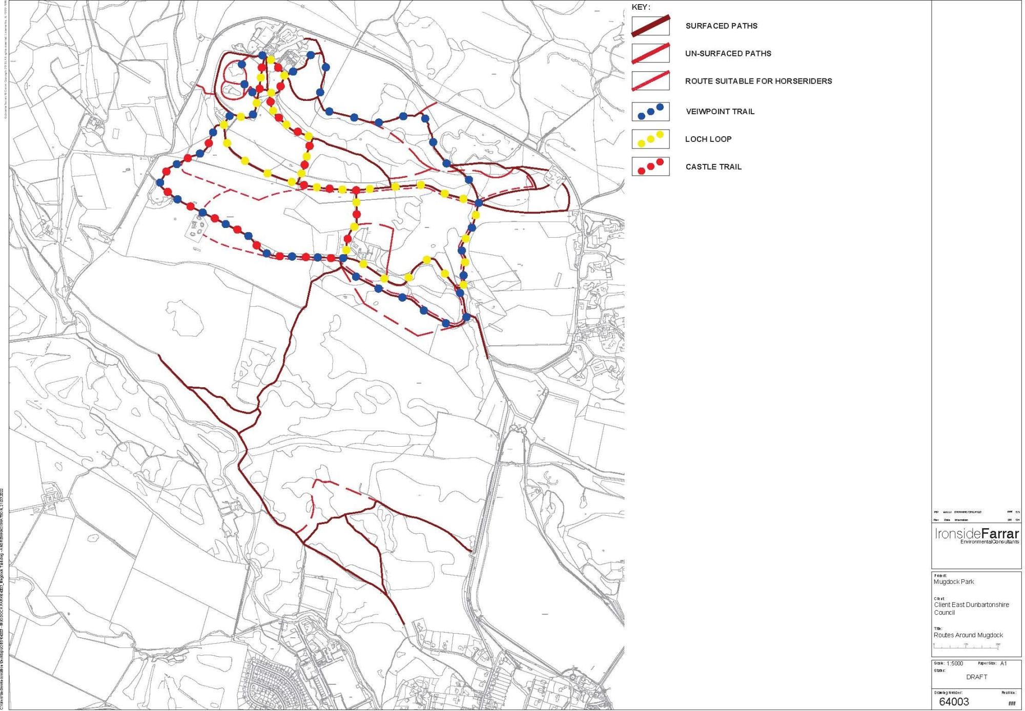
- Mugdock Trails
- Path Audits (2 sheets)
- Pondscapes
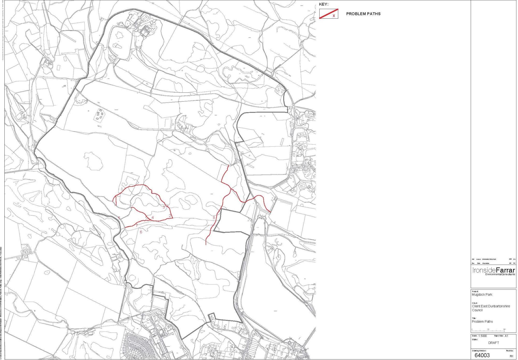
- Problem Paths
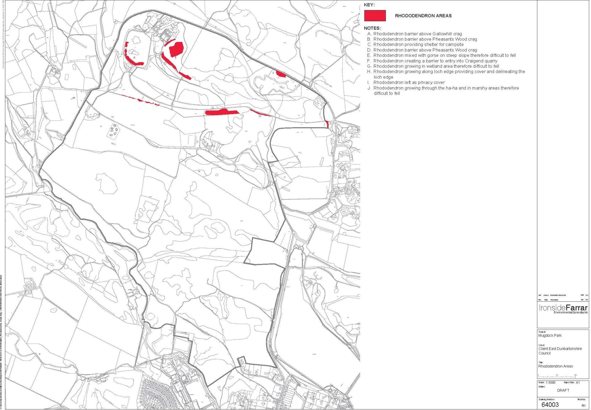
- Rhododendron areas
- Seating (2 sheets)
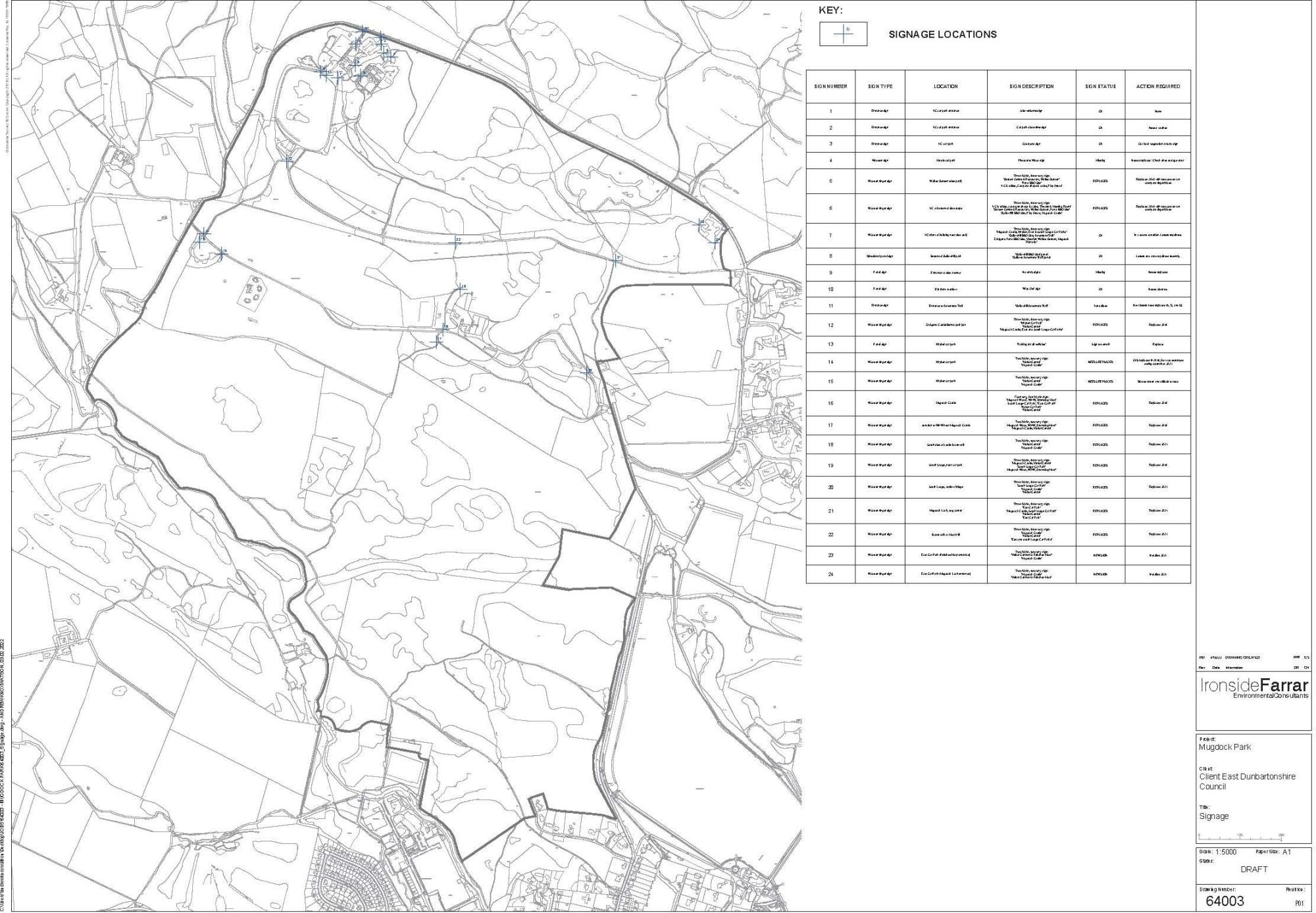
- Signage
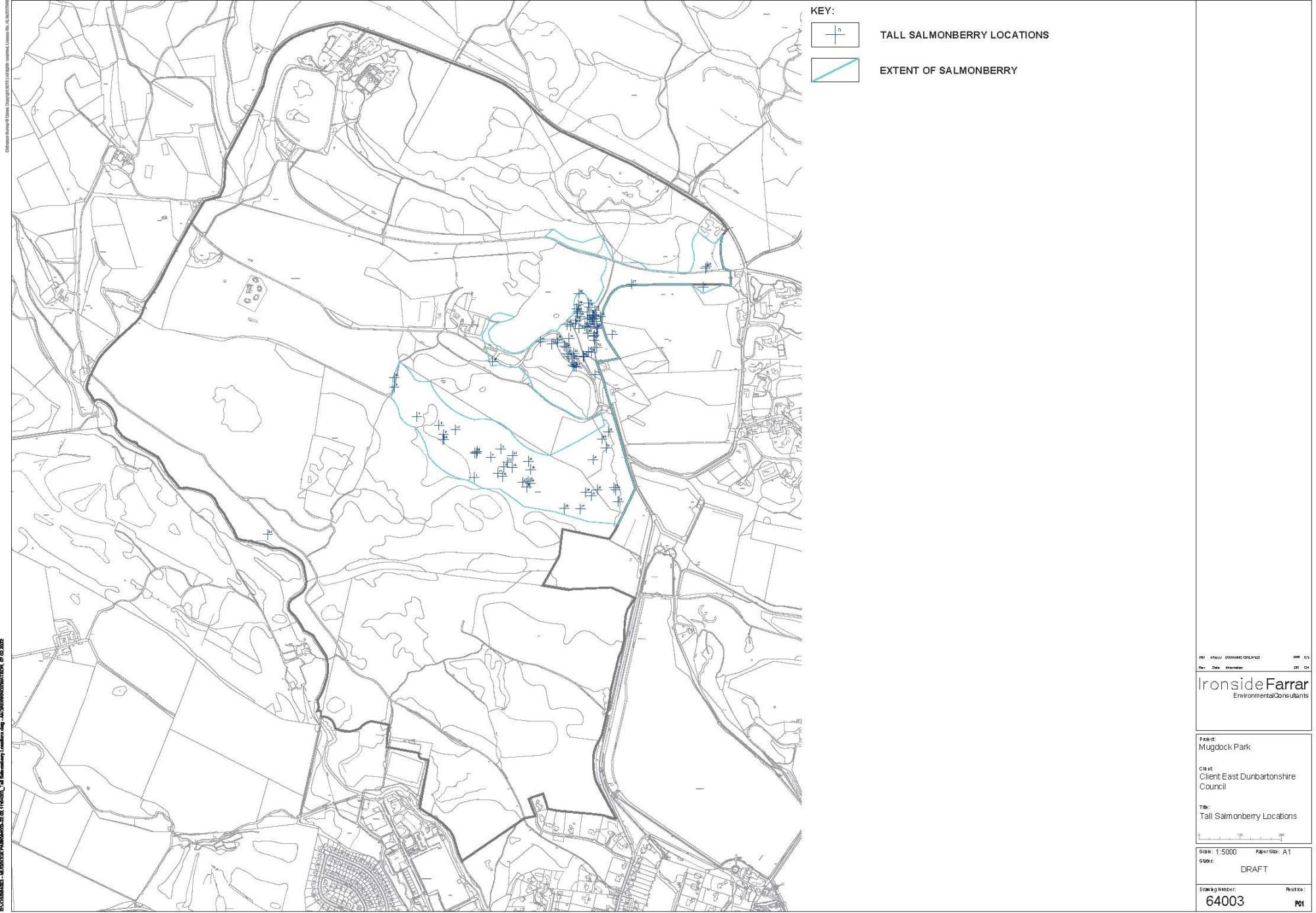
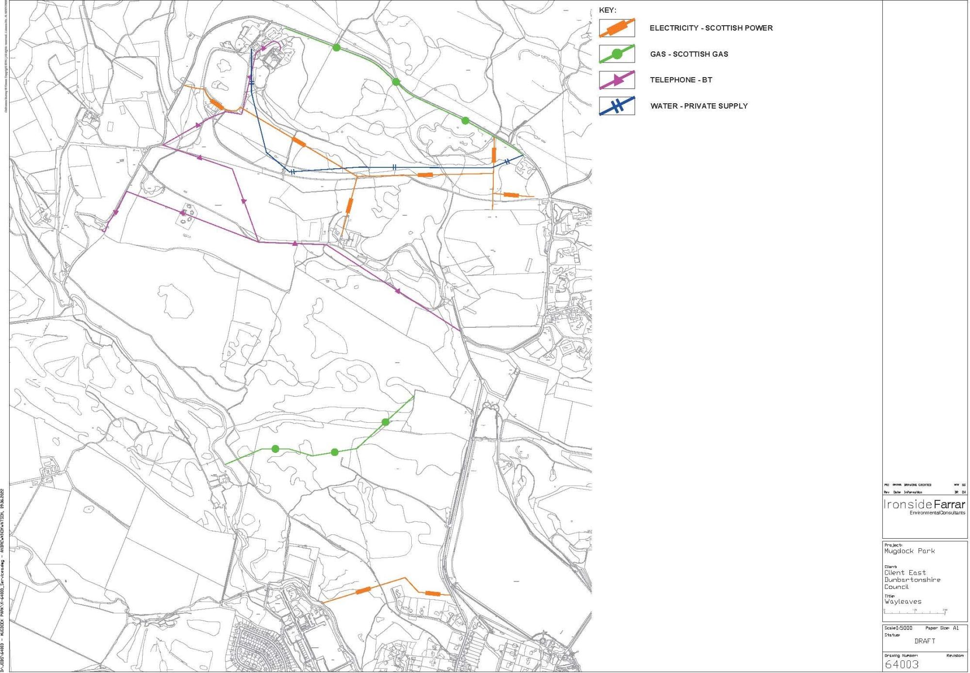
- Tall Salmonberry locations
- Wayleaves
These plans are contained within Appendix 1.
Click on images to enlarge

9.0 Management Prescriptions
Ideal Objective 1
To safeguard Mugdock Wood SSSI by ensuring compliance with all legal and other obligations
Operational Objective 1
To safeguard Mugdock Wood SSSI by ensuring compliance with all legal and other obligations through liaison with NatureScot.
Prescription 1
Liaise with NatureScot regarding proposed management for Mugdock Wood SSSI
On going liaison undertaken via email and regular meetings with SNH officer for Stirling area to clarify key actions and priorities.
Ideal Objective 2a
To maintain and enhance the swamp and mire habitats associated with Mugdock Loch
Operational Objective 2a
To maintain and enhance Mugdock Loch and associated hydrosere habitats through minimum intervention.
Prescription 2a
1. Manage through minimum intervention; Water-table level not disrupted or changed, loch outflow checked regularly and cleared if necessary.
2. Remove encroaching scrub every two years, treat stumps with Roundup Bioactive (method of application appropriate to Objective 7, prescription 7.1) remove scrub from S9, S27, M5, M23, M27 areas.
Ideal Objective 2b
To maintain and enhance the semi-natural mire and swamp
Operational Objective 2b
To maintain and enhance the semi-natural mire and swamp through limited intervention in order to maintain hydrological status and prevent scrub encroachment
Prescriptions 2b
1. Prevent further drainage or changes in the water table. The existing mires tend to occur in broad basins or follow well defined flush lines and it is unlikely that their hydrology should be adversely affected. However any work carried out on the site should consider the possible direct or indirect impact on local hydrology. Drains cannot be infilled at West Highland Way. Burcrooks pipeline will have impacts which require detailed consideration.
2. Allow existing drains to in-fill. The various shallow drains associated with mire outflows should be allowed to in-fill and develop naturally. Consideration should be given to the relationship between mire water-tables and footpath maintenance work. Work focused on drains and culverts associated with path routes to minimise flooding.
3. Block currently active drains. The deeper drains at mire outflows could be artificially blocked and thus help to promote a more natural vegetation expression or recovery. Continued use of log jams and brash to spread water within these areas.
4. Cut, treat and remove invasive scrub. Uprooting of seedlings/saplings and/or cutting and stump treatment should retain the existing open mire areas. Cutting back of vegetative expansion of established scrub may be necessary where it poses a problem. Gorse is cut back on a 2yr cycle to confine it to area and minimise encroachment
Ideal Objective 3a
To maintain and enhance Mugdock Wood SSSI
Operational Objective 3a
To retain and encourage the rich vegetation diversity and age structure of the woodland and to establish a monitoring programme and review process for the woodland.
Prescription 3a
1. Initiate a programme to control and eradicate invasive exotic trees/shrubs. Populations of these potentially aggressive aliens are currently reasonably limited, so control and removal should be practical. Containment zones should be established for rhododendron, salmonberry, Japanese Knotweed and sycamore, with removing of existing growth to prevent spread outside. These species are most widespread to the north-east of the site. Control will not be a quick process but the establishment of containment zones will prevent further spread, and allow for the gradual reduction of population sizes. Initial audits to map locations.
a) Sycamore seedling removal. Clearance of sycamore seedlings from selected areas in 5yr cycle whilst deer are still an issue.
b) Sycamore felling. Removal of mature sycamore from selected areas. Felled and left on site, stumps treated with Glyphosate. Sycamore control should be linked to regeneration work of future canopy. The mature sycamores are a feature of the escarpment and immediate removal may be considered drastic and unwarranted. However they tend to be suppressive (shade and heavy leaf litter) on the ground vegetation when growing close together and regeneration can be dense (and thus perpetuating the problem). Felling or ringbarking of some trees linked to sapling control could encourage local regeneration, especially of elm and ash.
c) Rhododendron control. Clearance of this invasive exotic shrub from those areas of the wood where it is encroaching. Treatment of cut stumps and any regrowth with Glyphosate.
d) Salmonberry clearance. Hand clearing of this invasive exotic Rubus species from all areas of the Country Park where it is encroaching. Hand pulling of any regrowth. Cut back and herbicide where safe to do so.
e) Monitoring of the success of the control programme should be set up under Objectives 12 and 13 (Prescriptives 12.1, 12.2 and 13.8).
Ideal Objective 3a (continued)
To maintain and enhance Mugdock Wood SSSI
Operational Objective 3a
To retain and encourage the rich vegetation diversity and age structure of the woodland and to establish a monitoring programme and review process for the woodland.
Prescription 3a
2. Retain and encourage vegetation diversity and age structure of the woodland by encouraging and allowing natural regeneration and retaining old tree growth with associated dead wood. Remove only senescent and dead standing trees which are unsafe to the public.
a) Retain old tree growth (except old coppice, undesirables and unsafe). It is recognized that although an ancient woodland, the actual canopy or timber growth is seldom over 200 years old (but often from much older bases). Mature timber would improve the woodlands age structure, and also provide additional niche space for associate wildlife (particularly invertebrate, fungi and lichens). Caution however will be needed for the coppiced trees (ash, alder and some birch and oak) as increasing age will likely result in breaking-apart and disease.
b) Identify and retain felled or dead standing timber (except where obstructing paths or representing a safety hazard). Old timber (felled or natural death) should be retained on site (unless commercially viable in the case of mature aliens or where representing a safety hazard; this measure would be of particular value to invertebrate and fungal groups.
3. Monitor grazing/browsing by roe deer and where necessary protect natural regeneration. The roe deer may be the only major grazer in the woodland system with any impact on the canopy regeneration (e.g. grazing pressure in winder on young saplings). If feasible, a census on numbers (see Objective 13, prescription 5) and the seasonal impact could produce useful management data. NatureScot HIA Survey on a 2yr cycle to establish and agree culling numbers.
4. Liaise with local tree producers and MFST to find suitable sources of local provenance trees and undershrub. In the likely absence of local native stock (or sufficient quantity) alternative suitable sources will need to be utilised. Given careful sourcing this could increase the genetic diversity of the woodland stock.
5. Construct 4x4m enclosure (deer fenced) covering a representative range of vegetation types. A large-scale exclusion zone, taking in several large examples of the main community types, would reduce any possible detrimental grazing pressure and allow for the establishment of monitoring and research programmes. Such a plot would need to be monitored frequently for security and be supported by a monitoring programme. Bracken removal and soil disturbance to encourage seedlings.
Ideal Objective 3a (continued)
To maintain and enhance Mugdock Wood SSSI
Operational Objective 3a
To retain and encourage the rich vegetation diversity and age structure of the woodland and to establish a monitoring programme and review process for the woodland.
Prescription 3a
6. Enrichment planting of shrubs in selected areas of identified woodland communities.
a) Plant hazel and holly in selected plots, in particular within the oak woodland (W 10e Quercus-Pteridium Rubus woodland Acer-Oxalis sub-community). The absence of hazel over large areas of the core woodland may be the result of past grazing pressure. Reintroduction of a few individuals (from local stock) perhaps linked to trial or thinning plots, would compensate for the lack of natural spread which is currently limited by distance of seed source. Works to commence only once deer control measures are successful.
7. Bracken clearance. Cut young bracken shoots annually for 3 years in sample plots ( 50m x 50m) within and outwith large exclosure to encourage natural regeneration. The suppressive mature of the dense bracken is well documented and regeneration is limited to open areas by paths or old drains. Local trial control plots, suitably treated, could encourage natural regeneration.
8. Assess the effects of coppicing, planting and bracken control management actions within and outwith the exclosure. The establishment of an enclosure and a number of trial plots with various management activities will provide an opportunity for a number of comparative studies on woodland processes which will be of benefit to the future development of the management plan. A monitoring programme should be set up under Objective 12.
9. Exclude grazing stock from woodlands. Periodically walk stock-proof fencing (site boundary with adjacent land-use) and repair as necessary. It is important that grazing stock are excluded from the woodland, particularly at this stage of woodland regeneration. However it is not practical to restrict access by roe deer.
10. Allow existing drains to continue to naturally in-fill. Past drainage patterns can still be seen (often vague) throughout the woodlands, although a few have been maintained in recent years. There is no need to try to retain an artificial system, except where there are access problems. Other drains should be left to continue to in-fill, with the longterm aim of a natural drainage system.
Ideal Objective 3a (continued)
To maintain and enhance Mugdock Wood SSSI
Operational Objective 3a
To retain and encourage the rich vegetation diversity and age structure of the woodland and to establish a monitoring programme and review process for the woodland.
Prescription 3a
11. Maintain open space habitats within the overall woodland.
a) The open areas of vegetation can be of high intinsic quality, with additional species diversity, and complementing the adjacent woodland habitats . Several quality examples of the different vegetation types should be identified and monitored for species composition and successful trends.
b) Consider control of undesirable scrub at quality open glades by removing young (new) invasive growth. Several open areas have a fringe of scrub species that provide an additional edge effect. However with time there is the threat of succession to scrub or woodland, especially in some wet areas, and it may be desirable to hold this process in check in the short-term.
12. Review success of deer management plan. Annual deer cull on-going with between 20 and 30 roe deer culled annually, night shooting licence granted annually by NatureScot and Herbivore Impact Assessments carried out by SNH Liaise and agree ongoing culling quantities with NatureScot.
Ideal Objective 3b
To maintain and enhance the semi-natural woodlands
Operational Objective 3b
To maintain and enhance the semi-natural woodland peripheral to Mugdock Wood, giving ecological management priority to those of higher nature conservation value.
Prescription 3b
1. Ongoing programme to control and eradicate invasive exotic trees/shrubs. (Retain only those exotics as prescribed under objective 9) locations audited. Sycamore control suspended due to impacts of ash dieback.
2. Ongoing programme to treat all stumps with Timbrel or Roundup Bioactive to prevent regrowth, and retreat following year should 1st application fail. Where possible do not burn cut material, but if necessary limit fire sites on areas of limited interest (cut Rhododendron to be burnt)
3. Retain and encourage vegetation diversity and age structure of the woodland by encouraging and allowing natural regeneration, and retaining old tree growth with associated dead wood. Remove only senescent and dead stranding trees that are unsafe to the public.
4. Monitor grazing/browsing by roe deer, and where necessary protect natural regeneration using tree guards once deer considered to be under control.
5. Liaise with local tree producers and MFST to find suitable sources of local provenance trees and undershrub. In the likely absence of local native stock (or sufficient quantity) alternative suitable sources will need to be utilised. Given careful sourcing this could increase the genetic diversity of the woodland stock.
6. Increase native woodland area to the west of the East car park by planting with tree and shrub species of local provenance.
7. Allow the natural succession of the established woodlands by the Allander and the Mugdock fringe by minimal intervention.
8. Allow the natural regeneration of the birch woodlands on Drumclog Moor by minimal intervention, within the limits of heathland maintenance (see OBJECTIVE 5).
Ideal Objective 4
To maintain and enhance the semi-natural grassland
Operational Objective 4
To maintain and enhance the semi-natural grasslands by active management in order to prevent undesirable successional changes
Prescription 4
1. Mow MG1a Arrhenatherum elatius areas of Castle Park to a sward length of 8-10cm once annually in the autumn. Remove cuttings.
2. Mow U4 Festuca-Agrostis Galium areas of West Park to 5-10cm sward length in twice annually in spring and autumn. Remove cut material.
3. Mow drier areas of Peitch's Moor grassland a) on a 2-3 year rotational basis: to a sward height of 8-10cm occurring in the late autumn or early spring: b) corridors beside paths to 5-10cm sward, cut 3-4 times per year in early May, late June, mid August and October.
4. Incorporate the mowing management of the over-spill car park and events site into the meadow management program where this does not conflict with other functional objectives.
5. Graze Craigend Park at a stocking level appropriate to a medium level of impact on the grassland sward. For this 6ha field this would require either 132 ewes for 24 weeks (September to March) or 72 ewes for 8 weeks in the backend (mid-August to October). (See also Objective 8 prescription 6)
6. Graze Khyber Park at a stocking level appropriate to a medium level of impact on the grassland sward. For this 22ha field this would require either 132 ewes for 24 weeks (September to March) or 396 ewes for 8 weeks in the backend (mid-August to October). (See also Objective 8, prescription 6.)
7. Slot seed the species-poor areas of Khyber Park pasture. Scarify the ground to open up gaps without destroying the whole sward. Spread cuttings containing seed heads produced from mowing operations on more species-rich swards elsewhere on the site.
8. Remove encroaching scrub on grassland and marsh of Central Park on a biennial basis and treat stumps with Timbrel or Roundup Bioactive.
9. Remove encroaching scrub on grassland and flush of Peitch's Moor on a biennial basis and treat stumps with Timbrel or Roundup Bioactive.
10. Rotational coppice of existing scrub on Peitch's Moor and Central Park.
11. Non-intervention of damp grassland in Castle Park.
12. Allow ecological succession of grassland in Quarry Park.
13. Remove encroaching scrub on grassy glades on Drumclog Moor on a biennial basis and treat stumps with Timbrel or Roundup Bioactive.
14. Introduce wildflower meadow areas around Craigend Castle
Ideal Objective 5
To maintain and enhance the remaining semi-natural heath
Operational Objective 5
To maintain and enhance the remaining semi-natural heath by safe guarding from mowing, grazing and scrub encroachment
Prescription 5
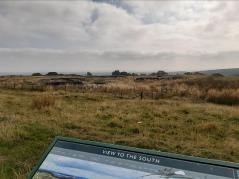
1. Identifying and mapping of areas of existing and potential heath on Peitch's Moor and Drumclog Moor.
2. Remove encroaching scrub from heath on Peitch's Moor on a biennial basis and treat stumps with Timbrel or Roundup Bioactive.
3. Remove encroaching scrub from heath to west of Craigend Quarry on a biennial basis and treat stumps with Timbrel or Roundup Bioactive. (See also Objectives 8, prescription 4).
4. Remove encroaching scrub from heath on Drumclog Moor on a biennial basis and treat stumps with Timbrel or Roundup Bioactive. Heath management taking place on Drumclog Moor Timing - Oct - March 2018 - 2022 Number - 5 - 10 areas cut each year by hand using loppers Area size - 1 - 2 square metres each Shape and location - free form, not squares
5. Prevent further bracken encroachment on Drumclog Moor.
6. Continue to cut and maintain wide firebreaks along path routes of Drumclog Moor.
Ideal Objective 6
To maintain and enhance the bare rock habitats
Operational Objective 6
To maintain and enhance bare rock habitats by limited intervention
Prescription 6
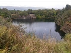
1. Consideration of maintaining bare rock facies suitable for colonisation by bryophyte assemblages of interest. On-going. A new area of bare rock was created at the north end of Mugdock Loch in 2014 when the unsafe crag was mechanically cleared of vegetation and loose rock and made safe
Ideal Objective 7
To maintain and enhance open water habitats
Operational Objective 7
To maintain and enhance open water habitats by promoting and encouraging survey and research in order to provide baseline information in order to make management decisions
Prescription 7
1. Manage Mugdock Loch by non-intervention until further information becomes available. Minimal use of pesticides and fertiliser in the water catchment area of the loch.
2. Macrophyte and aquatic invertebrate survey work to be undertaken by appropriate specialists. Liaise with SNH to include Mugdock Loch in list of intended sites for survey in 1998/1999 as part of their ongoing freshwater survey program.
3. Re-assess Operational Objectives when baseline survey data becomes available. Schedule annual SEPA surveys to establish water quality for health & safety.
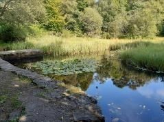
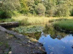
4. Manual clearance of emergent vegetation in Castle Park and Gallow Hill ponds, at a rate of less than one third of the area annually. Castle Park ponds managed by non intervention other than scrub clearance around pond edges. The eastern most Castle Park pond used regularly for pond study by Secondary schools. Sections of Gallowhill Pond manually cleared on a rotational basis. Pond vegetation left on banking to allow aquatic creatures to re enter the water, last section cleared winter 2016. Sections of wildlife garden pond and Holloway ponds (ponds to rear of Craigend Castle) cleared on rotational basis.
Ideal Objective 8
To maintain and enhance flora and fauna populations of key species
Operational Objective 8
To maintain and enhance flora and fauna populations of key species, particularly those with enhanced statutory protection
Prescription 8
1. Maintain Nuphar lutea population by non-intervention of freshwater habitat.
2. Ensuring continuation of woodland cover in order to maintain populations of Carex paniculata in wet woodland and orchid species in proximity to WHW Pseudobryum cin- clidoides, Trientalis europaea, Pyrola minor, Listera cordata and Chrysosplenium alternifoliuim.
3. Manage small pearl-bordered fritillary breeding sites by minimum intervention. Maintain areas in slightly later stages of succession but prevent scrub colonisation. Remove encroaching scrub on grassland and marsh on a biannual basis and treat stumps with Timbrel or Roundup Bioactive.
4. Manage green hairstreak breeding sites by cutting gorse/broom stands on a 10-year rotation (during March) and allowing regrowth from cut stumps. Manage adjacent grass- land for maximum habitat and floristic diversity, as outlined in Objective 4.
5. Manage purple hairstreak population by ensuring continuation of oak-dominated woodland cover.
6. Manage population of barn owl by ensuring protection of known traditional nest site (Craigend Castle). Consider erection of owl boxes in suitable habitat for roosting and nesting. Maintain areas of rough grassland habitat throughout the year for feeding. 2 barn owl boxes erected in Craigend Field, one box has been used successfully for several years. One Craigend Field barn owl box replaced Jan 2018. A third box erected to the west of Craigend Castle has been used by stock doves. One tawny box sited in woodland strip to west of Khyber Field 2016.
7. Manage population of long-eared owl by retaining stands of coniferous species throughout Park. Consider erection of nesting platforms in suitable habitat. Maintain open grassland habitats for feeding. 3 Longeared owl nest baskets erected in the park and on land surrounding the park. - 2012
8. Populations of bats should be managed by ensuring provision of historic breeding and hibernating sites. Consider erection of bat boxes in suitable habitat. Maintain diversity of feeding habitats to ensure plentiful food source. 2 BCT bat field surveys carried out annually. 2 - 4 bat roost surveys on 2 roosts carried out annually focussed around visitor centre buildings.
9. Locate and monitor other key populations. The locations of most of the species considered of interest are known , although there are a couple of exceptions (e.g. the exact locality of Hymenophyllum tunbrigense). The accurate marking of populations (including any new finds) should allow assessment and future monitoring. Population assessments and recognition of threats should be carried out.
Ideal Objective 9
To maintain and enhance designated landscapes features
Operational Objective 9
To maintain and enhance the designed landscape element of traditional estate features, including the policy woodland, the 'parkland' and the ha-has
Prescription 9
1. Retain exotic species in the areas of policy woodland where this is in keeping with current landscape value (and/or amenity and recreation value).
2. Maintain grazing regime (see also OBJECTIVE 4), cattle guards and retain mature trees in Craigend Park.
3. Ensure long-term continuity of 'parkland' trees in Craigend Park by carrying out a program of replacement planting.
4. Identify candidate trees and undertake a program of pollarding.
5. Survey the condition of the ha-has, recording maintenance and remedial work necessary.
6. Maintain and upgrade the ha-has where necessary through use of appropriate skilled labour.
Ideal Objective 10
To maintain and enhance the recreational and amenity facilities
Operational Objective 10
To maintain and enhance the recreational and amenity infrastructure and to undertake a review of visitor management policy
Prescription 10
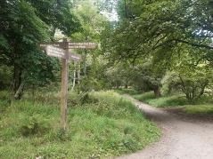
1. Review and upgrade existing path network, to establish a clear hierarchy with priority to those areas where erosion problems are apparent.
2. Source and commit adequate resources to upgrade and maintain recreational and amenity infrastructure to a high standard. Introduce covered shelter, additional BBQ site and both replace and extend play facilities.
3. Undertake a review, draw up and implement a visitor management plan.
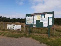
4. Improve way-marking, orientation and visitor information.
5. Consider retaining existing restrictions to vehicle access and parking in order to minimise disturbance to wildlife.
6. Erect gateway signage for the SSSI and appropriate signs and restrictive access points to discourage cyclists from sensitive parts of Mugdock Wood and Drumclog Moor.
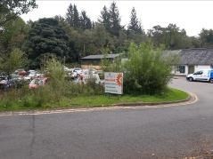
7. Rationalise existing Stable Block car park and establish clear arrival experience
8. Improve signage connections to Milngavie and the wider Green Network
9. Explore sustainable travel opportunities for visitors
10. Introduce feature area to facilitate commemorative plaques
11. Undertake yard improvements adjacent to the garden centre to improve security, safety and site perception
12. Review opportunities for increased use of Craigend Quarry for recreation
Ideal Objective 11
To maintain and enhance historic and built features
Operational Objective 11
To consolidate and conserve Mugdock Castle and Craigend Castle and to develop use of Craigend Walled Garden and the Kyber Park Works War II gun sites
Prescription 11
1. Complete consolidation of Mugdock Castle and grounds, promote visitor access and plan and provide interpretation (as part of an interpretative plan) in close partnership with the Mugdock Trust
2. Seek opportunities to conserve the remains of Craigend Castle and maximise awareness of previous use through introduction of interpretation
3. Develop Craigend Walled Garden to provide extended visitor interest compatible with Country Park aims and strengthen links with the Stable Visitor arrival point to build heritage connections.
4. Review safety and potential use and legibility of World War II gun sites, introduce raised walkway to facilitate views.
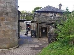
5. Enhance visitor arrival through upgrades to the Stables Visitor Centre building , the Courtyard and its surrounds to establish a clear heritage setting
6. Introduce interpretive public art elements to better explain site features and encourage wider exploration
Ideal Objective 12
To undertake monitoring to ensure the integrity of key features, to assess the effectiveness of management actions and to review management objectives.
Operational Objective 12
To undertake monitoring to ensure the integrity of key features, to assess the effectiveness of management actions and to review management objectives.
Prescription 12
1. Re establish monitoring of series of fixed-point photographic viewpoints. A photographic record of natural vegetation change and the effectiveness of management techniques will provide a ready and useful method of monitoring and will be of historical and educational interest.
2. Monitor key biological habitats using existing fixed point photography locations in SSSI.
3. Continue to monitor key flora and fauna populations Regular surveys carried out - Moth surveys using moth trap, butterfly survey transects throughout northern section of Park, field and roost surveys for bats. Occasional surveys - small mammal, amphibian
4. Monitor designed landscape features.
5. Monitor amenity and recreation facilities to gauge usage and guide Country Park development.
6. Monitor historic and built features.
7. Review management objectives in the light of the above monitoring.
Ideal Objective 13
To continue with site based research and survey in order to identify the full range of natural heritage features, and to underpin management
Operational Objective 13
To continue with site based research and survey of all major plant and animal groups in order to identify the full range of natural heritage features, and to underpin management
Prescription 13
1. Undertake survey of lower flowering plants. Further work on bryophytes and fungi would build on the existing records. Lichens are currently poorly recorded but could provide possible interest from epiphytic species of ancient timber and also research into pollution monitoring.
2. Undertake survey of higher flowering plants.
3. Undertake survey of breeding birds. Further survey work could readily build on the existing data and also be valuable for assessing potential conflict with any management proposals.
4. Undertake survey of mammals to augment existing squirrel and pine marten survey works..
5. Undertake study of roe deer behaviour in the area around and including Mugdock.
6. Undertake survey of herptiles.
7. Undertake survey of invertebrate groups. Past survey work has revealed a number of records of interest and further survey work is likely to be rewarding and will be useful for developing management prescriptions. Contact required with Glasgow University Natural History Group
8. Undertake survey of invasive exotic species
9. Establish surveys on the geology and soils. Details on local geology and soils would aid understanding of the vegetation structure and successional trends.
10. Encourage further research on archaeobotany (pollen cores). Preliminary survey provided some interesting data , and further study, may help to aid understand the mediaeval and earlier historic development of the woodland.
11. Encourage surveys of field archaeology. Field archaeology may provide details on old earthworks, drainage and boundary systems, aiding interpretation of human activities within the woodland. This would support existing works carried out by archaeological dowser who found sites in overflow car park and above East car park
12. Encourage further research into historical and management records. Historical literature records would help to interpret the existing structures and identify past management practice.
Ideal Objective 14
To develop and promote opportunities for visitor education and understanding
Operational Objective 14
To promote opportunities for visitor education and understanding by development of an interpretative plan, educational policy, use of on site resources and links with education departments
Prescription 14
1. Develop stronger working links with East Dunbartonshire & Stirling Council Education Depts and develop improved on site facilities and resources for supporting curriculum based education.
2. Review use of Resource Room and associated buildings and consider suitable covered shelter to provide improved facilities for education and wider community use.
3. Prepare education policy for the Park integrated with other aims and in support of existing brochure.
4. Develop and interpretative plan for the site as a priority. This is likely to include:
a) The design and placement of a number of interpretative panels along main path routes. Improved interpretative material should help to improve visitor appreciation and understanding of the habitats and management actions.
b) Provision of relevant literature and displays at Visitor Centre. Information and displays at the main visitor centres could inform the public of MCPs value and need for management work and also increase awareness in the general public of the existence and importance of habitats and in particular highlight the sensitivities of the SSSI.
c) Production of a series of leaflets on the key features of interest in the Park. Well designed and informative downloadable leaflets or Apps would help visitors appreciate the diversity and features of the woodlands, moor and associate habitats and help them to understand the value of the management work.
5. Encourage ongoing community involvement in the Park and its management. Involve conservation volunteers, heritage groups (Mugdock Trust) local people, community groups and schools in management tasks. The involvement of the above groups will be a valuable way of increasing public appreciation and understanding of the wood- lands, heath and other habitats and their need for management.
Ideal Objective 15
To ensure that management, survey or research activities on site are properly and safely planned, implemented and recorded.
Operational Objective 15
To ensure that management, survey or research activities on site are properly and safely planned, implemented and recorded.
Prescription 15
1. Quarterly meetings and reporting to the Joint Management Committee.
2. Hold annual management meetings with NatureScot.
3. Ensure recording of all management undertaken by producing annual management report.
4. Attend relevant courses on countryside management as they arise.
5. Develop inhouse facilities and resource to provide updated GIS mapping of all key areas of interest
10.0 Roles and Responsibilities
Implementation
The Land Management Plan will be implemented by EDC Mugdock Country Park Team working closely with the Ranger Service and colleagues in both East Dunbartonshire and Stirling Council’s. The LMP will be delivered alongside the Strategy with prescriptions to develop the core vision and protect and enhance the natural and historic site resources.
Plan Update and Review
The Land Management Plan will be reviewed on an annual basis to ensure consistency across both documents and continued parallels with Strategic Policy, Partner Council’s and NatureScot requirements.
Appendix 1 - Site Audit Maps
Click on images to enlarge

Appendix 2 - Funding Opportunities and Resources
Funding bodies
Forestry Grant Scheme supports the creation of new woodlands and the sustainable management of existing woodlands.
Magnificent meadows provides information of possible sources of funds for meadow restoration/creation
Peatland action funding supports on the ground restoration activities.
Scottish Rural Development Programme (SRDP) is now the main source of Government funding for rural land management, including management to benefit nature and landscapes.
The National Lottery Heritage Fund (NLHF) and Scottish Natural Heritage have launched the Biodiversity Challenge Fund (BCF) support large scale projects which will improve the health and resilience of the natural environment.
Resources
Funding bodies
Forestry Grant Scheme supports the creation of new woodlands and the sustainable management of existing woodlands.
Magnificent meadows provides information of possible sources of funds for meadow restoration / creation
Peatland action funding supports on the ground restoration activities.
Scottish Rural Development Programme (SRDP) is now the main source of Government funding for rural land management, including management to benefit nature and landscapes.
The National Lottery Heritage Fund (NLHF) and Scottish Natural Heritage have launched the Biodiversity Challenge Fund (BCF) support large-scale projects which will improve the health and resilience of the natural environment.
Resources
Advice on restoring and managing peatland can be at:
Advice on managing woodland for biodiversity:
Visit NatureScot's webpage on woodland management.
Advice of on creating semi-natural plant communities can be found on NatureScot's website.
Creating New Native Woodlands, Forestry Commission.
Conserving and managing trees and woodland in Scotland’s Designed Landscapes, a practical guide to caring for tree components in heritage landscapes.
Guidance on creating a traditional orchard.
Guidance on creating wildflower communities in woodlands.
National Forest Inventory (NFI) a regular updated UK wide inventory of all woodland cover.
Native Woodland Survey of Scotland (NWSS) is a one-off Scotland-wide survey of native woodlands and of plantation on ancient woodlands.
Appendix 3 - Report Maps
Click on images to enlarge